Friday, November 3, 2017

GCNP - Escalante Route

Left to Right: Me, Craig, Dallin, Alex

Last May I figured I should at least try to get one trip into the Grand Canyon this year. I wanted to head to an area I hadn't explored before so I put in for a permit for the Escalante Route. The plan was to head down the Tanner Trail and camp near Tanner Rapids (BB9 Use Area), then head downstream on the Escalante Route and camp near Hance Rapids off of Red Creek (BD9 Use Area), then hike out up the New Hance Trail. Granted I've been down Tanner Trail before, but then we went upstream to the confluence with the Little Colorado River.

My permit was for four and the only person from my usual GC crowd able to go was Craig. About two weeks before the trip, I contacted Dallin, a hiker I had chatted with about the Colorado Trail and asked if he'd like to go. He was up for the trip along with his friend, Alex.

Sunday, September 17, 2017

Colorado Trail - Day 25

September 5, 2017
Finished Trail 484.6 (13.5) 6983'

I was the first one out of camp this morning and was on trail at 6:50. While I was breaking camp, I said hi to one of the hikers that were in their tent last night.

The day started out with a two mile climb gaining about 600' so it was a pretty easy climb. After that, it was pretty much all down hill to the end.

I kept leap frogging with the couple that was in the tent. It turns out they have hiked both the AT and the PCT. Unfortunately, I don't remember their names.

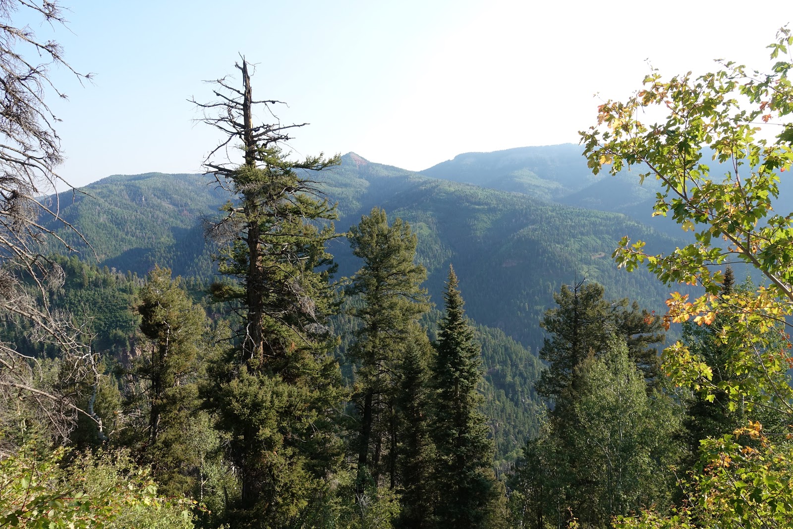
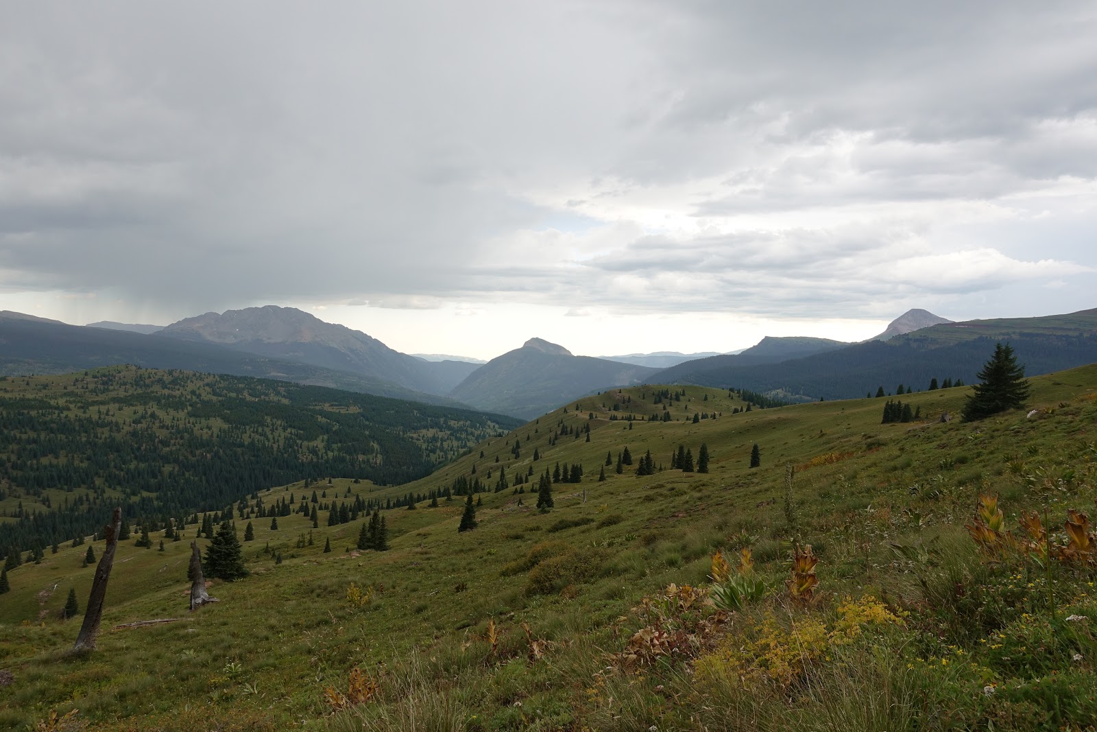
The day was mostly in the trees but there were a few views along the way.

I got some water shortly after I started, but was thirsty from not drinking enough over night and was low. The trail came to a stock tank that was pretty green. Two men were there and they said the creek not far down the trail was running. We talked for a few minutes. It turns out that the wife of one of the men is on the CT Board of Directors.

When I got to the stream, I drank a bunch of water and also cleaned up some. I rinsed my shirt out and gave myself a quick wipe down. It felt nice to wipe the grime off my face.

There were several people along the trail that I talked to. There was a couple that used to live in Arizona that I talked to out walking with their dog. The man had a Show Low, AZ t-shirt on.

As I got nearer to the finish, the forest started looking a bit like Arizona with Ponderosa Pine and scrub Oak.

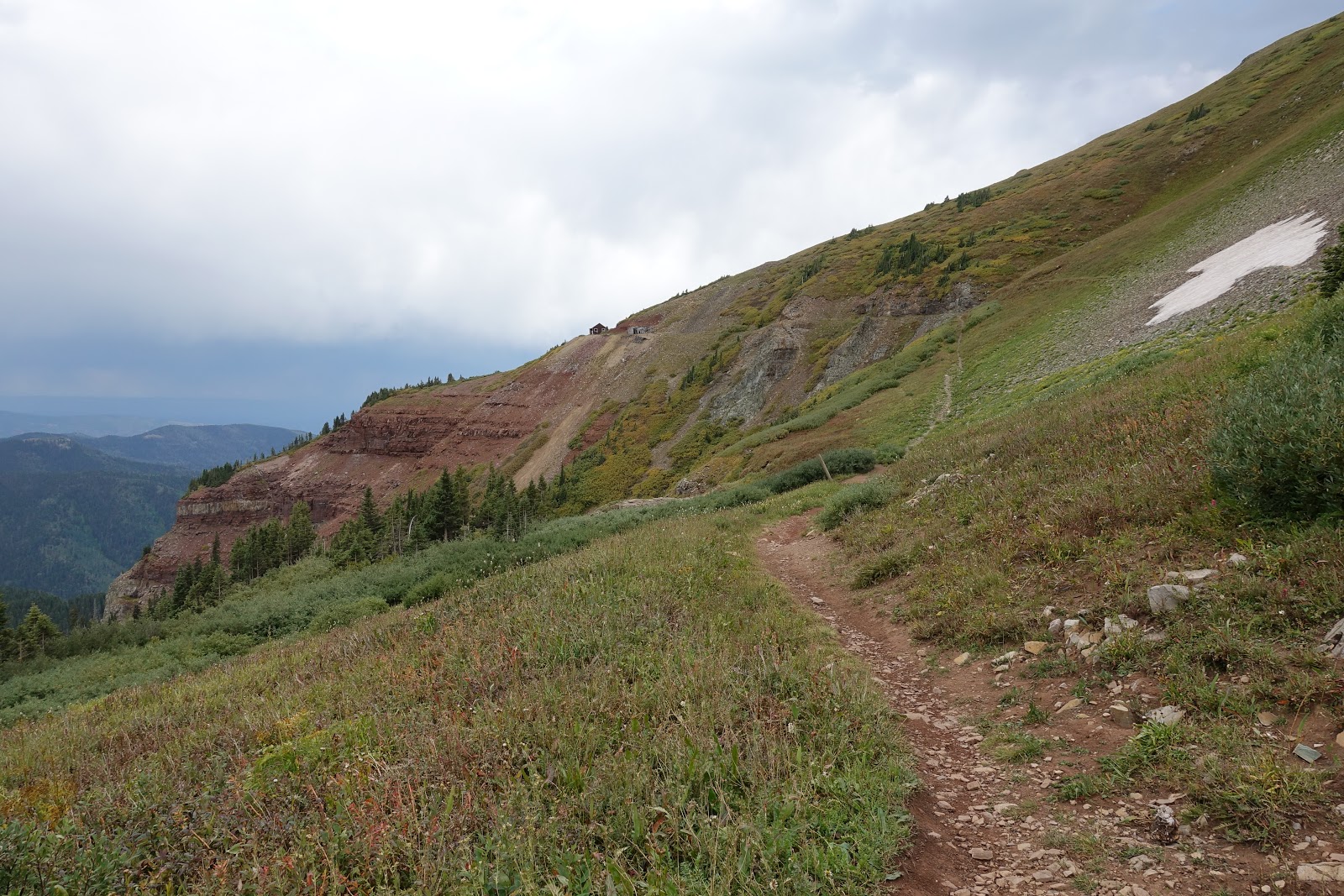
When I got to Gudy's Rest, I sat on the bench for a few minutes and enjoyed the view. It's just four miles from the end. I was getting really close.

I wanted to get done, to complete the CT, but I also didn't want it to end. I've had such a great time on the trail and was getting nostalgic as I neared the end. The start seemed so long ago and it seemed strange to think I wouldn't be camping again for awhile. Still, I wanted to finish!

I wasn't far behind the couple, so I slowed down so I could finish after they did, so I'd have the end to myself. I don't remember what I was thinking when I finished. I walked up to the trail sign and put my hand on it and stood there for a bit. I took some pictures and video, then walked out to the road and started hitching to Durango. It was actually rather anticlimactic.

I was walking down the road hitching for a few minutes when a truck pulled over. It was the couple I talked to on the trail that used to live in Arizona. I had to sit in the bed but that was okay. Also, they were giving Nathan I ride to town too. He must have finished shortly after I left the trailhead.

I was dropped off right in front of Carvers Brewing Co. I said thanks and they drove off when I realized I didn't even congratulate nor say goodbye to Nathan. I felt bad about that. Anyhow, Carvers gives a free pint of their Colorado Trail Nut Brown Ale to CT finishers. I had a few, it's tasty beer. I spent several hours at Carvers eating, drinking, and conversing with other trail hikers. I made a reservation at the Durango Super 8 and another hiker, Emily and her ride, Mark, gave me a ride to the motel. It worked out great. What a trip!


View from Gudy's Rest

Celebrate!

Finished!


Colorado Trail - Day 24

September 4, 2017
Camped at 471.1 (26.6) 9,072'

I slept good last night and it wasn't cold either. I was up and on the trail about half past seven.

Archery elk is in season and I saw and talked to a few hunters. The trail crossed a lot of roads early on and at one there were a couple of trucks parked and two bucks, one with a really nice rack. I thought that was funny as I'm sure an elk hunter can probably have a deer tag too.

I stopped to take a picture when I heard a big crack and thud. A snag toppled over right onto the trail not far from where I was. It would have been really close if I hadn't stopped.

The trail went over the last 12k ridges today, then dropped thousands of feet into a very lush and damp canyon. I'm glad I'm not camping in it.

On the descent, I caught up to Nathan. He'd been a mile or so ahead of me all day. We're camped at the same spot. Three other hikers are here too. I talked to one but the others are in their tent.

Only 13.5 miles left to the end of the CT! It's hard to believe I'm almost done; tomorrow's the day!

Sunrise from Camp


Taylor Lake


Gaines Gulch Waterfall

Colorado Trail - Day 23

September 3, 2017
Camped at 444.5 (25.8) 10,768'

I was comfortable last night, even with the rain and storming going on. It stopped well before morning so everything was dry when I got up.

A doe was hanging out in camp all night and this morning just waiting for me to pee. She must need more salt in her diet.

I was slow getting going and didn't get on trail until 7:45. I wanted to do at least 24 miles today and a late start doesn't help.

The trail was nice today with some great views and a lot of forest. The forest has seemed a lot healthier since Molas Pass. I hope it stays that way.

My progress seemed really slow this morning. I think I stopped a lot but maybe it was the late start. At any rate, things picked up this afternoon once I started Segment 26 at Bolam Pass.

When I first reached the pass, I got some water and ate. When I was about done, another CT hiker walked by and we said hi. Not long after I got going, I caught up to him when he stopped to take a picture. He is Al, or Night Owl.

From there, I was able to keep a good pace and made really good time. Maybe five miles in it started to rain and then turned into a hailstorm. The hail stones were good sized and quite loud hitting the umbrella. The worst part was the water on the trail. I did manage to keep my feet mostly dry. Once the storm passed, it was nice for the rest of the day.

On top of Blackhawk Pass, I heard a rockfall. There was a hiker down the trail that stopped and was looking up. I wondered if he was able to see it?

A couple miles later, I caught up to him at the last reliable water for 22 miles. His name is Nathan and he didn't see the rockfall but did hear it.

I drank a bunch and filled up my 3 liter capacity there. I also had some food. Nathan did the same as did three bike packers that came by.

Nathan and I left together and had a really great conversation. Nathan is 19 and lives in Denver. This is his first backpacking trip and he seems to be doing it right. He hiked with Berno for three days too.

When I found a place to camp, Nathan decided to go a bit farther. I hope I see him again tomorrow.

It's hard to believe I only have 40 miles left and will be done in two days.

Salt Depraved Doe

Last Night's Camp (Already Partly Broke)


Saturday, September 16, 2017

Colorado Trail - Day 22

September 2, 2017
Camped at 418.7 (21.0) 11,608'

It was windy last night so I put the bat wing up on the tarp to block the wind. That helped some.

I was on the trail about 7:20, maybe five minutes behind Eric. I had a quick hello with a father son pair that camped in the same area.

The day started with a big and steep descent to the Animas River. After a bit, I caught and passed Eric. There were a fair number of backpackers out for the holiday weekend, some with climbing gear.

Eric took the train to Silverton so we said goodbye at the junction to the train stop. I continued on to where the trail crosses the tracks and waited around hoping to see the train but left before it came.

I got water at Molas Creek for the climb up to Molas Pass. The climb was tough but it wasn't bad because I wasn't out of breath at the lower elevation.

Near the top, I went to the Molas Lake campground store. I got some more food as I figured I was a little short for the rest of the trail. I also got a Gatorade and a Klondike bar. I was also able to dump my trash. In all, the side trip took a bit over an hour, definitely worth it. What would you do for a Klondike bar?

From there, I made it to Molas Pass and continued into the next segment. I was a bit tired and hungry so I stopped near Little Molas Lake. Several Mt. bikers rode by while I rested.

Once back on the trail, I passed a couple of nobo CT hikers. Once I got higher, the storms rolled in and I got intermittent rain, but nothing bad. My umbrella is working out really well with these afternoon showers.

I passed a hillside full of sheep and talked to a shepherd for a bit. Well, I tried as he was from Espanola and spoke little english.

Near the end of the day, two hunters on horseback rode up as I was eating. We talked for a few minutes. I saw them later setting up to glass. They asked where I was camping for the night and I said I heard of a site a short distance from there. They agreed.

When I got to the site it started to rain but it was under trees and I didn't have to rush pitching my tarp. It stormed for awhile this evening but I was fairly protected and didn't have any issues at all.


Durango to Silverton Rail

Animas River

Looking Back Down at the Animas River

Molas Lake and Campground


Little Molas Lake


Colorado Trail - Day 21

September 1, 2017
Camped at 397.7 (21.8) 12,105'

I pitched my tarp on a slant and got up and moved it to a more level place during the night. I'm glad I did because I was much more comfortable, also it rained and I didn't have to worry about sliding out from under it.

Sometime during the night, I got up to go pee. I put my shoe on but something was in the way. I thought my sock was bunched but that didn't help. So then I thought the insole was out of whack so I stuck my hand in the shoe and felt something furry; I think a pika was in there!

With the rain and the open campsite, the tarp was pretty wet when I packed up, so I put it in a plastic bag to keep everything else dry.

We were a bit slow getting started and were on trail at 8:10. Before we left, Mike and Kathy went by. It was them! Next, Chris went by. Thru hiking the CT is Chris' first backpacking trip ever.

There was a lot of up and down today, all above 12k, so it was a tough one. We passed Mike and Kathy and chatted with them for a bit. Later we caught Chris and talked with him too.

Eric stopped by a stream for lunch so I stopped and set my tarp out to dry. I had some Fritos and some other food too and gathered some water.

Late in the day a hail storm rolled through, then turned to rain. It cooled off a lot and my hands got cold, so I put my fleece hoody on so I could warm my hands in its pocket. I wear it every night but this was the first time I wore it hiking this trip.

The CT split off from the CDT today. Goodbye CDT, it was fun! If my calculations are correct, I hiked a 317.2 mile section of the CDT. Nice!

The day ended with a 600' switchbacked descent to an old mining camp where we camped. There were great views on the way down.

Today was especially beautiful. The eye candy was never ending. I had a lot of pictures to choose from, here're several.

Last Night's Camp


Mike and Kathy

Cataract Lake

Eric

Me Enjoying the View