- I ditched my hiking boots and traded them in for a pair of trail runners. I used Altra Superior 2.0 shoes with Dirty Girl Gaiters with great success. I made it through well over 125 miles with no blisters or any other foot issues. Well, my feet were tired and ready for a break when I made it to Elden Pueblo.
- I got a new pack, a ULA Circuit. I was extremely pleased with how it performed.
- I used a ZPacks Roll Top Blast Food Bag and Pack Liner Dry Bag.
- I left the tent at home and instead brought a sil-nylon tarp that I sewed for my shelter. The tarp was made from a Ray Jardine Ray-Way tarp kit.
- I used a Sawyer Mini filter instead of the MSR Miniworks EX Microfilter I had been using.
- I carried a new full length Thermarest NeoAir XLite sleeping pad. I found it much more comfortable than the 3/4 length Thermarest Pro-Lite I had been using.
- I left my camp chair and Kindle at home.
June 12, 2015
Start: Passage 27, Pine trailhead.End: Passage 27, Washington Park trailhead.
Miles: ~17.
My wife and daughter drove me up to the Pine trailhead where I continued hiking the Arizona Trail. After we said our goodbyes and I got on the trail, they went and explored Tonto Natural Bridge.
A little over two years ago I backpacked a good chunk of the Highline trail from the Hatchery trailhead along Tonto Creek to the Pine trailhead, plus I’ve day hiked along parts of this portion of the Arizona Trail several times so I’m familiar with the Arizona Trail from here to Washington Park. Starting out on familiar ground and knowing what to expect for this day’s hike was a comforting feeling.
After about a mile, I went to find the first stage of geocache Pine Trailhead (Multi-Cache). It’s an old cache, hidden in 2001, that I tried to find once before but made a mistake when getting the coordinates to the final location. Today I knew what my mistake was so I had no problem finding where to go to the final. It was nice to sign the log.
I continued the climb up the trail. It wasn’t as steep as I remember it being when I descended it two years ago. Of course I was tired the last time down the trail so maybe that’s why I remember it being steep. Once I reached the Red Rock Spring trough, I dropped my back and went and found geocache Geronimo 2 Pine, another cache I previously looked for and didn’t find. Today I found it easily, it’s nice when that happens.
When I went to look for the cache, there was a group of men with the forest service hotshots taking a break at the Red Rock trail junction. We chatted for a bit, then I went back to my pack and had a snack before continuing down to Weber Creek. A short time later, I passed another group of hotshots heading towards Red Rock.
The brush was really tall and overgrown as I approached Weber Creek; it was really cool. At Weber Creek, I took another short break having a snack and getting some more water. I remembered getting water here and setting up camp well after dark two years ago after a long and tiring day on the trail travelling farther than planned when an expected water source was dry.
A couple miles past Weber Creek, the trail joins an old road. Off to the left there’s a camping area and I noticed a three or four inch pipe that appeared to have a spigot there. I went and checked it out and sure enough, there was a ball-cock valve that, when opened, let out cold and clear water. This water source isn’t on the water report but I bet it’s pretty reliable.
All along the trail, the water sources were generally running so I never had to worry. At passage mile 11.5, I stopped at a small ravine with trickling water and several nice pools that I remembered from two years ago and grabbed a liter of water and ate a snack. This water isn’t on the water report either.
The trail is really nice along here. It winds its way in and out of the forest and there are great views all along the way, both of the rim and of the country falling away.
In one forested area, I turned off the trail to find geocache Nome’s Rock. I had to fight my way through some Manzanita but it wasn’t too bad. I actually found a flagged trail that took me most of the way to it. Once there, I quickly found the cache then took a break and enjoyed the view and ate a late lunch. I was able to find an easier way through the Manzanita back to the trail but I had to cut back away from a small drainage.
At this point, it was getting late and I still had about four miles left to Washington Park, my target for the day so I stopped dawdling and started hiking. There was some up and down and it was on a part of the trail I’ve travelled several times so I knew exactly what to expect. I passed the Girl Scout camp property and a short time later arrived at Washington Park.
Once at Washington Park, I spotted a nice place to set up camp so I dropped my back and started pulling stuff out. There was one person there, a lady. She asked me if I was okay, if everything was alright. I didn’t think I appeared distressed but maybe so after hiking most of the day. I said I was fine and that I was going to set up camp for the night. She told me that there’s no camping but she wouldn’t tell anyone. We laughed about that and I mentioned that I believe that is to stop people from driving up and camping, but that it’s okay for backpackers to camp. I really don’t know if that’s the case but I do think it is. Anyway, she left and I set up camp then walked over to East Clear Creek to get water for dinner and tomorrow.
This was the first night I used the tarp shelter I sewed this past week from a Ray Jardine Ray-Way kit. I’m not the best sewist and some of the seams look pretty bad but I’m happy with how it turned out. It set up nicely and I was nice and snug under it. There was no rain during the night but there was clouds and some distant thunder so I thought it prudent to use.

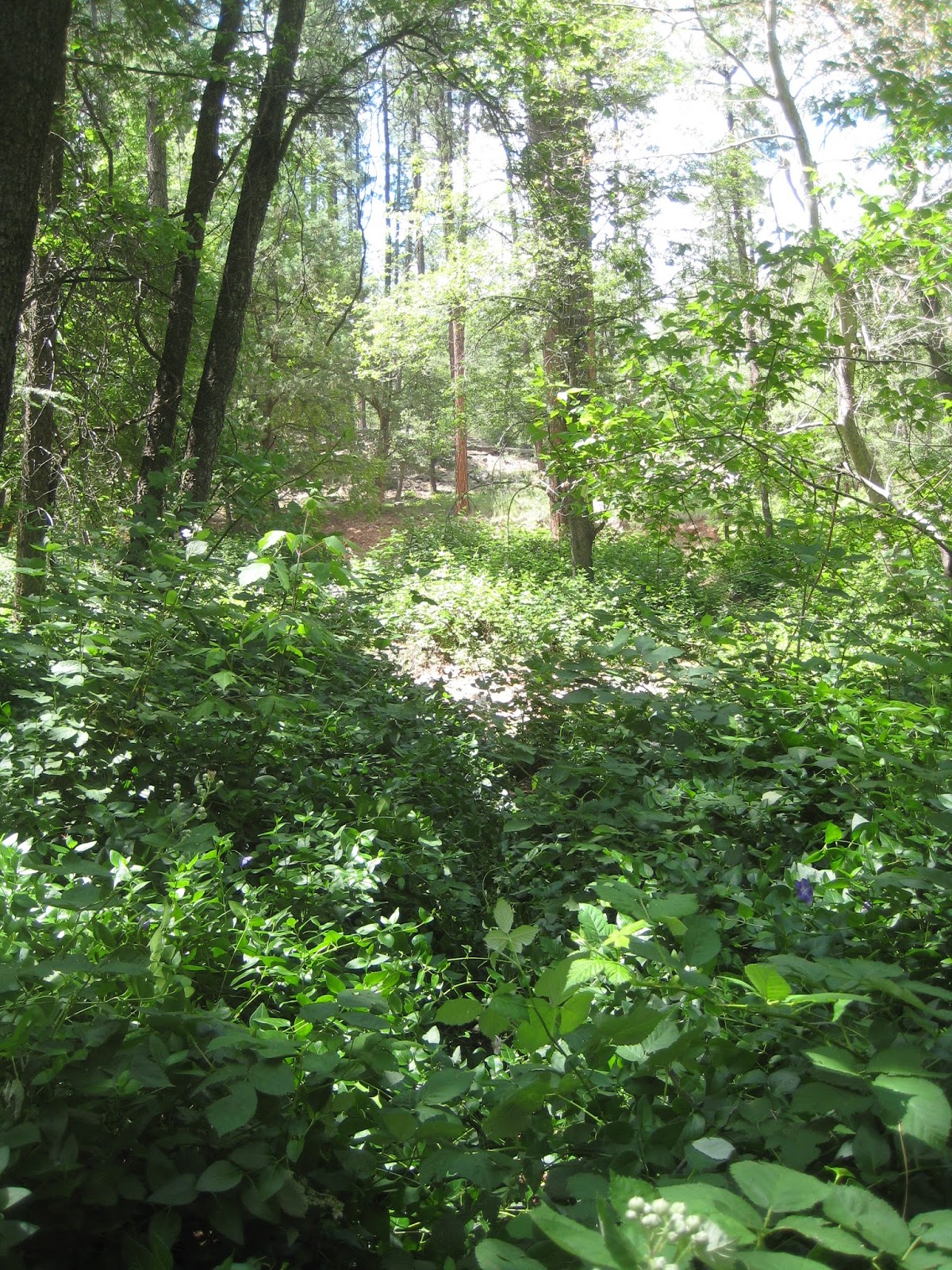 |
| Nearing Weber Creek. |


June 13, 2015
Start: Passage 27, Washington Park trailhead.End: Passage 29, mile 3.2 (N 34° 38.462 W 111° 12.661).
Miles: ~22.
I slept pretty good last night, especially considering it was my first night on the trail. I always seem to have trouble the first night and sleep comes easier as the days go by. I bet the new sleeping pad played a part in it.
 |
| Camp at Washington Park. |
I decided not to cook breakfast this trip. I really don’t like instant oatmeal and it always takes me a long time to eat it, especially when I start gagging. Instead of oatmeal, I brought Pop Tarts and raspberry fig bars. I ate a Pop Tart while lying in my bag and saved the bars for along the trail. That saved tons of time and I had broken camp and was on the trail by half past six.

I’d never hiked up the Railroad Tunnel trail before. It goes from Washington Park up to the Mogollon Rim in about two miles. It’s never very steep until near the end and mostly travels along an old road paralleling East Clear Creek. There’s five geocaches along the trail and one at the top so it took a long time. The first geocache I stopped at was Cheese Whiz Kids, then On the Way to Battle-Crossroads. The first was a nice sized cache and was easy to find. The second took me awhile as it had been close to two years since the last find and it was buried in dirt and debris from the passage of time. Next was 2 Room Haus, placed near a ruin of a stone building. Geocache On the Way to Battle-Red Cliffs was trouble getting to. It is placed on a ledge where I had to cross a bunch of sticker bushes and climb up to. I found a better way out that avoided most of the stickers but my legs had already been scratched all up. Too bad it wasn’t August, then maybe I could have had some fresh blackberries. After I found On the Way to Battle-Uphill, last found over two years ago, I followed the Railroad Tunnel Loop trail.
 |
| 2 Room Haus. |
A short distance up the loop trail, I heard and saw a group of backpackers heading down from the rim. They dropped their packs and started coming up the loop trail to see the railroad tunnel. When I reached the switchback closest to the tunnel trail, I dropped my pack and headed up to check it out. Once I reached the tunnel, it wasn’t long until the others joined me. They were a Venturing Crew hiking from the rim to the Pine trailhead and were planning on camping at Camp Geronimo with their associated troop that evening.
At the tunnel entrance there was a ruin of a stone building. The tunnel wasn’t too deep either. Maybe 75’ or so. I didn’t need a flashlight to reach the end. I guess funding ran out and operations closed before much was dug. Unfortunately I left both my camera and some food I meant to bring back at my pack.
None of us stayed at the tunnel very long. We talked for a bit and then headed back down. We said our good byes when we reached my pack, they continuing down the loop trail and I headed up it. A few minutes later I was on the rim and reached the start of passage 28 and the marker for the Battle of Big Dry Wash. I dropped my pack there, found geocache Battle Marker and ate the food I meant to have at the tunnel. I put on some sunscreen and got going. With the caching and the tunnel, it took me over two and a half hours to cover two miles.
From the top of the rim, the trail follows a dirt road for about a half mile until it reaches General Springs Cabin. The cabin was built about 100 years ago and is one of three along what is called the Cabin Loop Trail. I stopped to check the cabin out then continued along the trail where it soon turned to single track heading down Fred Haught Canyon. Another half mile or so, I stopped to find geocache General Springs Quest then continued a short distance and found geocache Venturer's 2003 AZ Trail Project. There was frequent water for the few miles the trail followed the canyon and it was quite wooded. It was a very enjoyable stretch of trail.
 |
| General Springs Cabin. |
 |
| Fred Haught Trail. |
After a few miles, the Arizona Trail leaves the Fred Haught Trail and works its way out of the canyon. I stopped at the junction to find geocache Fred Haught Trail Letterbox, then took a short break having a bite to eat and twenty winks.
Once past the junction, and away from the canyon, the trail warmed up for a while but then the thunder heads started to build in the sky and the heavens began their rumbling as I hiked across Battleground Ridge. From there, the trail turns towards East Clear Creek. I started thinking of the hike my son and I had nine years ago when he was eleven. We set out from Rock Crossing campground and followed the AZT for about two and a half miles before turning around at a small camping area. I was heading right towards that spot and was planning on lunching there.
That was such a great hike with my son. I remember he wanted to wear my hat and how it started to rain and thunder on our return. How we started racing to get back to camp before the storm hit. And we did, with about thirty seconds to spare when the skies opened up and drenched everything. Like they were looking to do again today.
I reached the spot, took off my shoes and ate some lunch when the hail started. Really? The skies seem to like to open up when I’m resting. I quickly put my shoes back on and grab my things and get under a large ponderosa, don my rain jacket, get everything back in my pack and the hail and rain stop. I take the jacket off, don my pack and get back on the trail, and am grateful the storm wasn’t as violent as when my son and I finished our hike.
Soon I’m hiking down to East Clear Creek. There’s no flow but there are some large pools. I cross the canyon then climb up the other side. It’s a harder climb than I remember but it didn’t take too long to get up on Blue Ridge and back on the flats. When I reach the trailhead at FR 751 it starts to rain again so I quickly put my rain jacket on, walk about a football field and the rain stops. I take it back off and continue hiking. Part of the trail is that clay mud that adds a pound or two to your feet. I slog through and soon the trail is covered with gravel. Someone actually dumped wheel barrows of gravel along the trail. How nice!
About when the gravel ends, I drop down to the Blue Ridge campground where I stop to get water and backflush my filter. The camp host stops by and we chat. He asks if I got stuck in the hail that came through about fifteen minutes earlier. I said no and asked if it would be okay to hang out at a campsite for a bit and relax. Yes, he said, that would be fine. He left and of course, it starts pouring. I decide it’s a good time to use the facilities and hide inside for a bit. One can only hang out in a vault-toilet so long so I go back outside and stay close to the door, out of the rain. There’s a couple camping across the way with a fire going and a couple of pop-up shelters. I wander over and ask if they’d mind if I hung out until the rain stopped. They were happy to let me and offered me some hot chocolate. Yes please! Their names are Carol and Mike and I tell them that will be easy to remember since my oldest sister and oldest brother have the same names.
About twenty past five the rain stops and only the trees are dripping. I thank Carol and Mike for their hospitality, heft my pack and continue along the trail. Soon I stop to find geocache J.Wavrly & the ODF 7. It’s a short distance off trail in the wet grass so my feet get a bit wet but no big deal. As I near the end of the Blue Ridge passage, I veer off trail to find Chipmunk Hollow Cache. This time there’s no wet grass just a bunch of pine needles to cross. I head back to the trail and shortly I’m crossing highway 87 and starting passage 29, Happy Jack.
 |
| End of Passage 28, Blue Ridge. |
My hope was to get as far as Ron, another AZT section hiker I met in the Superstitions got on his second day out from Pine. He made it to mile four. It was close to dusk when I had less than a mile to go when I rounded a bend and saw what looked like a perfect campsite a short distance off the trail. Well heck, it looked so inviting and I really had no idea what it would be like were Ron camped, so I decided to set up camp. I pitched my tarp over an area with about six inches of pine needles and who knows how much duff under that. What a comfortable place to make my bed.

 |
| Second Night's Camp. |
June 14, 2015
Start: Passage 29, mile 3.2 (N 34° 38.462 W 111° 12.661).End: Passage 29, mile 25.3 (N 34° 45.886 W 111° 24.414).
Miles: ~22.
Last night I went to sleep with the chorus of cows bellowing back and forth to each other. It was no lullaby, but what could I do except close my eyes? Sleep came soon enough on my soft bed of pine needles and before I knew it, I woke to turkey gobbles. I laid there listening for a few minutes while eating breakfast. Soon enough, I was breaking camp. My tarp was soaked from heavy dew so I folded it up and stuffed it in an outside pocket instead of inside the pack. My right hamstring was a bit sore too. I seemed to have tweaked it sometime last evening one of the numerous times getting up to do camp chores or something. I worried how it would be walking.
I was on the trail around seven and fifteen minutes later I passed where Ron camped. There were several nice places to camp but it was lower and may have been a bit colder than where I camped. I decided I wanted to make it to where Ron camped on his third night.
After walking a bit less than five miles, I reached Sheepherders tank and decided to stop for water and to dry my tarp and some other damp gear. As I turned off the trail, a coyote bounded away from the tank and some cows wandered off. I picked a nice spot on one edge and hung things out then got some water and relaxed. I ended up staying way too long, but everything was dry and I was rested and fed. I made a plan to get water at Pine Spring about 13 miles away.
 |
| Sinkhole. |
 |
| Sheepherders Tank. |
When I got back on the trail, things had warmed up and my hamstring started to bother me as I walked. I shortened my stride a bit, that helped some and I was able to continue on okay but slower than I would have liked.
Most of the day was spent road walking. These were lonely roads so I never saw anyone. I just plodded along at my slower pace and baked in the sun. The roads tend to be much more open than the single track trails. Somewhere before Gonzales tank, I found a Nature’s Valley wrapper so I picked it up. A short time later, I found a two liter platypus so picked it up. I wondered if whoever lost it had enough other water containers. I plodded on, right past where the trail turned onto a different road and then saw Gonzales tank. Wait, I’m not supposed to be here. I could have continued and the road would have joined back up with the AZT, but I decided to backtrack instead. I don’t know why, it added about a third of a mile and a couple hundred feet of climbing just to descend.
 |
| Road Walking. |
After that climbing, the trail turned off the road and back to single track. I was back in the trees and hot and tired and hungry so I stopped for a break. I sat there for a few minutes and just wanted to dry out. All of me. I hadn’t seen anyone all day but I decided to gather my things and walk a bit farther off trail where I took off all my clothes, hung them up to dry, then laid down and rested. I don’t know how long I laid there, but it felt great, so relaxing. Finally, I got up, got dressed, and was back on the trail. Not five minutes later I passed a cyclist pushing his bike up the hill I was walking down.
I continued on. More of the same. The forest is gorgeous but it all blurs together. Somewhere I passed an empty bottle of Coors stuck on a small branch. I wished it was cold and full; Rocky Mountain fresh. I passed Wild Horse Tank. It was full but Pine Spring was just a couple miles farther.
I finished all my water as I approached Pine Spring. The metal tank was empty, broken, the valves were open, no water. I found the spring. There was no spring box that I could find, just a muddy mess with no easy way to the water. This wasn’t good. I found some pieces of wood and laid them into the edge of the spring. An ATV drove by and I asked if they had any spare water. No. Back to the spring. I went out on the wood and dirt rose. I deepened the water by pushing the muck aside then went back to shore and waited. I went out on the wood again. More dirt rose. I filled the bottle, it was dark. I filtered the water but had to backflush the filter often, a big stream of black. Yuck. I was tired, hot, my leg hurt and now this. I was deflated, so much so that I was driving with blinders – just get the water. Finally I had all my bottles filled with some bad tasting and not very refreshing water. It took a long time to filter and I knew there was no way I’d make it to where Ron camped. Whatever I told myself I didn’t really care but I did, I wanted to make my first 25 mile day and I wouldn’t. But I would hike until nightfall and see how far I could get. That I would do.
 |
| Pine Spring. |
I got everything packed up and was back on the trail, more road walking and I walked right by where the trail turned onto another road and kept on going. About a quarter mile later I figured that out and turned around. Crap. The road ends and turns into single track going around Bargaman Park. I come upon a small stream trickling along. Crap, why didn’t I just look at the datasheet and see that there was another good water source a bit over a mile past Pine Spring? I dump the dirty black water out of the one bottle and rinse it out several times. Then I backwash the filter several times and pour out one of the bottles of filtered water and filter this water. It only tastes a little better so I keep two liters of Pine Spring water and continue hiking. More time lost but worth it I think. About a half mile down the trail I realize that I got water emptying from Bargaman Tank but I really should have got the water that was feeding the tank. Crap. What the heck is a matter with me today?
I get about three miles past Bargaman Tank, I’m tired and my leg’s been bothering me all day, and it’s past sunset so I pull off the trail and set up camp next to some oaks and Ponderosa on the edge of a large meadow. It’s damp and feels like it might get cold but it doesn’t. I have dinner, take some ibuprofen, hope my leg feels better in the morning, and go to sleep.
 |
| Home Sweet Home. |
June 15, 2015
Start: Passage 29, mile 25.3 (N 34° 45.886 W 111° 24.414).End: Passage 30, mile 20.5 (N 35° 01.013 W 111° 28.391).
Miles: ~26.
I was hoping to hear some elk last night. I thought they may play out in the meadow but I didn’t see nor hear anything, not even cows. Maybe I just slept through it, I don’t know. I thought there would be a heavy dew again last night, but it wasn’t too bad. The tarp was damp, but not soaking wet like it was yesterday morning. I felt refreshed this morning and felt good. My leg wasn’t bothering me but I was being careful of it, especially when getting up off the ground. I was moving from worry to optimism for the rest of the hike.
 |
| Last Night's Camp - Time to Pack Up. |
Shortly after I was on the trail, I came to Shuff’s Tank. It was full and the water was fairly clear. I stopped and filled up my water. My filter wasn’t working so well after Pine Spring, so I kept that water I had filtered but would use the newly filtered water first and hopefully I wouldn’t need too much of it before I reached Double Springs campground where I planned to get water next.
 |
| Shuff's Tank |
Once I finished getting water, I continued on down the road I’d been on. About a quarter mile later, I notice that the trail turned off the road back at the tank. I was going to just cut across back to the trail but the topography didn’t appear good for that so I just turned back around and backtracked, then got on the trail, some nice single track through the forest. That section was really enjoyable not long after I arrived where Ron camped, where I wanted to reach yesterday. I stopped there and had second breakfast, enjoying the day and then continued on to the end of the passage.
 |
| Ron's Camp. |

I stopped for a few minutes at Gooseberry Springs trailhead, the start of passage 30, Mormon Lake to put on sunscreen. There were some people camping a bit off the trail and I debated whether to ask for good water to replace the nasty stuff I was carrying. I decided to not bother and hoped I would come across somebody else closer to the trail. That worked out perfectly because a couple miles later there were some people camping very near the trail. As I approached their campsite, I announced myself and told them that I had some rather nasty tasting water and was wondering if they wouldn’t mind sparing some of theirs. They were more than happy to share and I was able to get some cold fresh water to replace my Eau de Moo. They were visiting from Wyoming and were going to be camping there another week or so. I thanked them and got back on the trail which, I found out, one of their tents was pitched over. Okay. I went around the tent then not far afterwards was their toilet. Used toilet paper was strewn about over the trail. It was gross and I just felt like yelling at them to make a proper latrine but I refrained since they did give me water. They’re going to be there another week and they are making no effort to have a proper latrine and take care of their defecation; yuck!
 |
| Gooseberry Springs Trailhead. |
 |
| Tent in Trail. |
Yesterday there wasn’t a single geocache along the trail for me to find. I realized that I hadn’t looked to see what geocaches I’d be passing today so I took a quick look. Unfortunately, I had already passed one but it wasn’t far off a forest road. I did see there were two up ahead by Navajo Spring so I decided to find them. First I found geocache Navajo Spring which was at a nice overlook of the spring and the old watering troughs. From there I dropped down and found geocache Along the Navajo Trail. I followed the Navajo trail a short distance before cutting back up to the Arizona Trail.
 |
| Troughs at Navajo Spring. |
Shortly after getting back on the Arizona Trail, I stopped for some food and a rest. There was a controlled burn recently so there were some charred areas but there was plenty of non-burned areas to lay out and relax. A few minutes after taking my shoes off and starting to eat, there was a crack from a branch breaking on a tree across the trail from me, then a squirrel crashed to the ground and ran away. I couldn’t help it, but I was in hysterics. It was hilarious. Poor squirrel.
 |
| Controlled Burn, aka Land of Flying Squirrels. |
The trail goes right through Double Springs campground so I stopped and had lunch and filled up with water. I sat at a picnic table while eating and the pump for the spring was continuously grunting about once a second. It would be awful to camp there and have to listen to that noise, especially when trying to sleep. On my way out of the camp, I rinsed my shirt off and rinsed my head and face. That felt super refreshing.
It was about half past four when I left the campground and I had about eighteen miles in. Only seven miles to get to 25. My leg wasn’t bothering me at all today and I was rested. I could do this. After covering four more miles it felt like I might be developing a hot spot so I decided to stop and take my shoes off for a few minutes and check things out. My feet seemed fine but I decided to have a snack and let them air for a few minutes. Once I was back on the trail, my feet felt fine and didn’t bother me the rest of the day. The trail flattened out and followed an old rail bed. That was pretty neat to hike by and it was fast going. I made it another four miles before calling it a day for 26 miles. I was happy.
 |
| Rail Bed. |
 |
| Tonight's Camp, Time to Move In. |
June 16, 2015
Start: Passage 30, mile 20.5 (N 35° 01.013 W 111° 28.391).End: Passage 31, mile 7.8 (N 35° 09.320 W 111° 35.583).
Miles: ~21
Sometime last night my legs were bothering me and I really wanted to stretch them but there just isn’t enough room in my bag to do so, so I unzipped it and used it like a blanket instead. That worked great, I was able to stretch my legs, I was plenty warm, and it was much easier to rollover and change what side I was sleeping on. I’m thinking I’ll just keep the bag unzipped for the remainder of this trip, maybe forever.
There were four geocaches along the trail this morning. I reached the first, Stumped not too long after I started. The next, No Cows Here was just after I crossed Lake Mary Road. The last two were a bit farther and were on opposite sides of the trail. I first found Cousin Trees then walked straight to Mom’s Birthday. The latter being close to the Horse Mesa trailhead so I was able to take the trailhead trail back to the AZT where there was a group of campers with, wait for it, a tent pitched across the trail. I said good morning and apologized for walking through their camp but the trail went right through it.
From here the trail follows roads along the mesa and is exposed to the sun. It wasn’t bad at first but it got warmer as the day wore on. At first the trail heads directly north then curves to the east where I had my first glimpse of the San Francisco Peaks. I was hoping to see some antelope and herds of elk as Anderson Mesa is prime habitat for them. I didn’t see any antelope but I did see a lone elk.
 |
| First Glimpse of San Francisco Peaks |

A couple of weeks ago a new stretch of trail was completed that joins the AZT and Lakeview campground. I decided to head down to the campground and take an extended break. The trail was farther than I anticipated, maybe a mile but I had a great break. I found a campsite that wasn’t being used and opened my pack up and had a good lunch. I gave myself a sponge bath and even did laundry. I felt very refreshed and was ready to get back on the trail.
 |
| Lake view on the way to Lakeview. |
 |
| R We Lost Yet? |
The hiking was quite warm as I continued along Anderson Mesa. At one point the trail went near the edge so I went to check out the view of Upper Lake Mary and its dam and the expanse of grass and marsh that make up Lower Lake Mary. I passed Vail Lake off in the distance and then went right by Prime Lake and the entrance to Lowell Observatory’s Perkins telescope. By then the heat was getting to me so I found a shady spot under some junipers and rested and had some food and drink.
 |
| Upper Lake Mary |
 |
| Prime Lake and San Francisco Peaks |
When I was getting back on the trail, I heard a mountain biker ride by. I yelled hello to him and he stopped and I went to ask him if he knew the water situation was up ahead past Marshall Lake. He said he rode out there yesterday but didn’t see anything. I had enough for the rest of the day’s hike but wasn’t sure if I’d have enough for dinner and the morning. With the heat, I was drinking more water than I had anticipated but still had plenty for the time being. He asked what the trail was like where he was heading. I told him and then we said our good byes.
Finally the trail entered some forest and dropped down to Marshall Lake. From there it followed a road a short distance to the Marshall Lake Trailhead, the start of Passage 32, Walnut Canyon, where the trail turned back to single track. Maybe a half mile later I met three equestrians riding out. They asked if I’d take their picture and I asked how far they’d ridden and if there was any water up ahead. They mentioned a muddy cattle tank but that was all.
 |
| Marshall Lake Trailhead. |

Soon after that, I reached the intersection for the Flagstaff Resupply Route. I continued along the trail and was soon climbing out of Walnut Canyon. Along the way up, I went to find another geocache, Samson Won, but it was on the side of the hill and I was running out of light so I quickly decided to continue on and find a place to camp for the night.
Once on the rim of the canyon I found a nice place above the trail hidden in the trees to camp. It was a lovely night so I decided to cowboy camp. There ended up being a road nearby and there were a few cars that stopped and I could hear people talking. I have dinner and pull my phone out and have service so I try to give Barbara a call and leave some messages and texts about when and where to pick me up tomorrow. I even futz around on Facebook for a few minutes before crashing for the night.
June 17, 2015
Start: Passage 31, mile 7.8 (N 35° 09.320 W 111° 35.583).End: Passage 32, mile 7 Elden Pueblo.
Miles: ~17.7
I slept well under the stars last night but had to get up once. For some reason, it takes me a long time to get moving. I stay under my sleeping bag and eat breakfast. Eventually I get everything packed up and get on the trail. It seems like I kept having to redo things; I’d forget something so I’d need to open the pack back up. I’d close it and then remember something else.
My pack’s light when I start as I have very little water. After about two miles I stop at a wildlife tank to refill and to find geocache, Fisher Guzzler Trick Tank (ABC Tank Series). The water is very clear, cool, and tastes really good. I decide it’s the best water I’ve had this trip, perhaps the best I’ve had all along the Arizona Trail. It takes me a fairly long time to filter the water, even though it is clear. My filter hasn’t been working the best since Pine Springs. I leave with over a gallon of water, thinking that should be enough for the rest of the day. I notice the heavier pack as I get back on trail.
 |
| Walnut Canyon. |
 |
| Good Water! |
The trail wanders along through the Ponderosa away from the rim of Walnut Canyon so there are no views except the trees. After a few miles the trail crosses a side drainage and then ascends back to the top. Near the top, I drop my pack to go look for geocache, Walnut Canyon 1, but soon come to a fence with a closed area sign. It turns out that access to the cache is via another trail. I turn around and get my pack and continue along for a bit farther then cut off the trail to find another geocache, Fisher Point Trail. I enjoy finding older caches and that cache just turned ten the end of May.

When I come to the trailhead at FR303, I have to find geocache, Mr. Shewalter, Thank You, dedicated and in memory of the founder of the Arizona Trail. If it weren’t for him, would I ever even be here? After finding the cache, I find a nice shady spot near the trailhead and take a break and eat some food. There are two ladies nearby talking about the movie, “Wild,” about Cheryl Strayed.
The trail continues wandering through the forest, then crosses Walnut Canyon road and the Ponderosas turn into Junipers and it gets warmer as the trail descends towards I40. I pass a portion of the trail that is being moved a short distance from its current tread. When I reach I40, I head west along the access road a short distance to find another geocache, Louis C. Cox Memorial Cache. It was hidden in October 2002. After finding it, I turn around and head back along the access road, to where the Arizona Trail crosses under I40, the end of passage 31 and the start of passage 32, Elden Mountain.
 |
| Looking Back. |
 |
| Looking Ahead. |
 |
| Crossing Under I40. |
After crossing the interstate, the trail turns west and follows near the Burlington Northern Santa Fe railroad line. As the trail winds through Juniper and Pinyon, several trains passed. The day was warm and I was drinking more water than I had any other day on this trip. Much of the trail was black lava rock that made the trail even more sweltering than with just the sun. I was hot and tired so I stopped in the shade of some Junipers and had some food and drink. I filtered the rest of the water I had and checked the time. I planned to be at Elden Pueblo by four and would have to keep a strong pace to make it.
 |
| Mount Elden and the San Francisco Peaks |

The trail followed the edge of a butte, I think for Sheep Hill, then crosses a meadow where it then turns onto Rain Valley Road. From there it heads west into another hill that is a large gravel pit. It was hot and now it was dusty too. Shortly after, the trail becomes part of some Flagstaff trail system as it works its way northwest to highway 89. By now I’m almost out of water when I come to a bridge crossing a stream of nice clear looking water. This stream isn’t on the water report and I debate whether I should just fill a liter bottle with it. I have less than two miles to go and I’ll barely reach my destination by four so I continue without stopping. I later find out the water is effluent from a water treatment facility. About a half mile from highway 89, I run out of water but I still have about a cup and a half of Gatorade. Perfect.
 |
| Crossing Under Highway 89 |
I cross under highway 89 and walk the short distance to Elden Pueblo. I arrive almost exactly at four. How do I manage to finish so close to the arranged time? Barbara and Katie haven’t arrived yet, so I find a shady spot under a pine tree to rest and wait. That’s fine with me, I don’t mind waiting for them since they’re doing me a favor and that’s why I don’t want them to have to wait for me.
I’m about asleep when they arrive. It’s so good to see them. I’m happy. I get cleaned up some and then we head to Beaver Street Brewery for dinner. What a way to end the hike.