October 20, 2015
Last February, on the second day of my hike from Picket Post to Roosevelt Lake, I met Ron, who was section hiking the Arizona trail too. We ended up hiking together for the rest of that trip. He continued on to Pine and also completed the trail from Pine to the South Rim. We decided to team up and complete our last hundred miles of trail together. Ron lives in Portland, Oregon and yesterday he flew into town, got a rental car, and spent the night at my house.
Our plan was to drop my truck off at the Stateline Campground, then drive to near the South Rim and camp for the night. Simple enough, but it would be a lot of driving.
We left in the morning and drove up to Flagstaff where we stopped and I got gas, then we had an early lunch at a nearby McDonalds. The low tire-pressure light turned on in Ron’s rental so he stopped to find some air and I continued on. When I got to the turnoff for Horseshoe Bend I stopped and found geocache,
Trucker Stop #16 - The Muleshoe. It was at two memorials for a six person fatal accident including five family members and a state trooper. Very sad.
A few minutes after I found the cache, Ron showed up and we hiked to the Horseshoe Bend overlook. It was about a mile and a half walk and was well worth it. It is a very scenic view of the Colorado River and the Grand Canyon. While there, I also found the Earth-Cache,
Horseshoe Bend, Page Arizona.
 |
| Horseshoe Bend |
After checking out Horseshoe Bend, we drove into Page and stopped at a Sonic for a milkshake and to figure out how to get to the Stateline Campground. The milkshake was yummy!
To get to the campground we turned onto a dirt road off of US 89. Shortly after we were on the road, it was washed out in places from some recent storms. A dual-sport rider was coming the other way so I asked what the road was like. He said the creek was running across the road in places and was pretty bad. Ron got in the truck and we drove ahead a couple miles to see what it was like. We decided we wouldn’t be able to get the rental car to the campground so we turned around and left my truck on the side of the road, about ten miles from the campground. We’d figure out how to get to it at the end of the hike, or just walk another ten miles.
We left a change of clothes and some water in the truck and then we got in the rental car and headed back towards Page. We stopped at Cameron to have dinner. It was getting late and neither of us really felt like camping tonight so we found a room in Tusayan for us to stay at. After we checked in, we went and had a beer before calling it a night.
October 21, 2015
Start: South Kaibab Trailhead, GCNP.
End: Cottonwood Camp, GCNP.
Miles: ~14.7.
I slept pretty good last night, especially since it was in a hotel bed instead of outside in the cold and rain. I got up and took a quick shower since it would be my last opportunity for a while. Afterwards, Ron and I walked over to McDonald’s for breakfast. A sausage McMuffin and orange juice did the trick for me. We went back to the hotel, checked out and hopped in the rental car and drove to the Grand Canyon National Park’s main visitor center. I got all my stuff together and wandered down to the bus stop. There was a bus about to leave for Yaki Point. Ron came down, we boarded the bus, and off it went. Perfect timing.
The bus went directly to Yaki Point and along the way, we talked to a gal who was leading a group a ways down the trail for a day hike. She told us a rain storm was moving in in the next couple of hours. It wasn’t long before we were off the bus, where we took a couple minutes doing last minute things. For example, I turned on my GPSr and SPOT on, and used the facilities. Someone left a set of trekking poles at the bus stop. We checked to see if it was someone from the group but it wasn’t. We walked to the trailhead, took some pictures, and headed into the canyon a few minutes after nine.
 |
| Ron at the South Kaibab Trailhead |
It wasn’t long before we reached Ooh Aah Point where we stopped and listened to a tour guide for a minute before continuing. Ron mused whether this was ooooh, aaaah point or ooh aaaaeeeeh (I’m plummeting to my death) point. Thanks for that!
Not long after we left Ooh Aah Point, it started raining. That was earlier than we expected. We stopped and put our pack covers and rain gear on and opened the umbrellas. A few minutes later we arrived at Cedar Ridge. I was working on completing geocache,
Rim to Rim, an earth cache. Basically, I had to gather information at certain places on a rim to rim hike to answer a bunch of questions about the Grand Canyon’s geology. I thought Cedar ridge was the first of several stops but it wasn’t, Skeleton Point was and it was raining pretty good when we arrived there.
Somewhere along the way, I stopped to get a drink and dropped my bottle. It landed on its top and broke the cap. Crap! I could sort of screw the cap on but it wasn’t secure at all.
Around twenty past eleven, we made it to the Tonto Trail junction and stopped over by the outhouse to rest out of the rain. We talked to another hiker who was heading east along the Tonto. He’d been out for a few days but I don’t remember where he started (probably around Boucher or Hermit) or where he was heading.
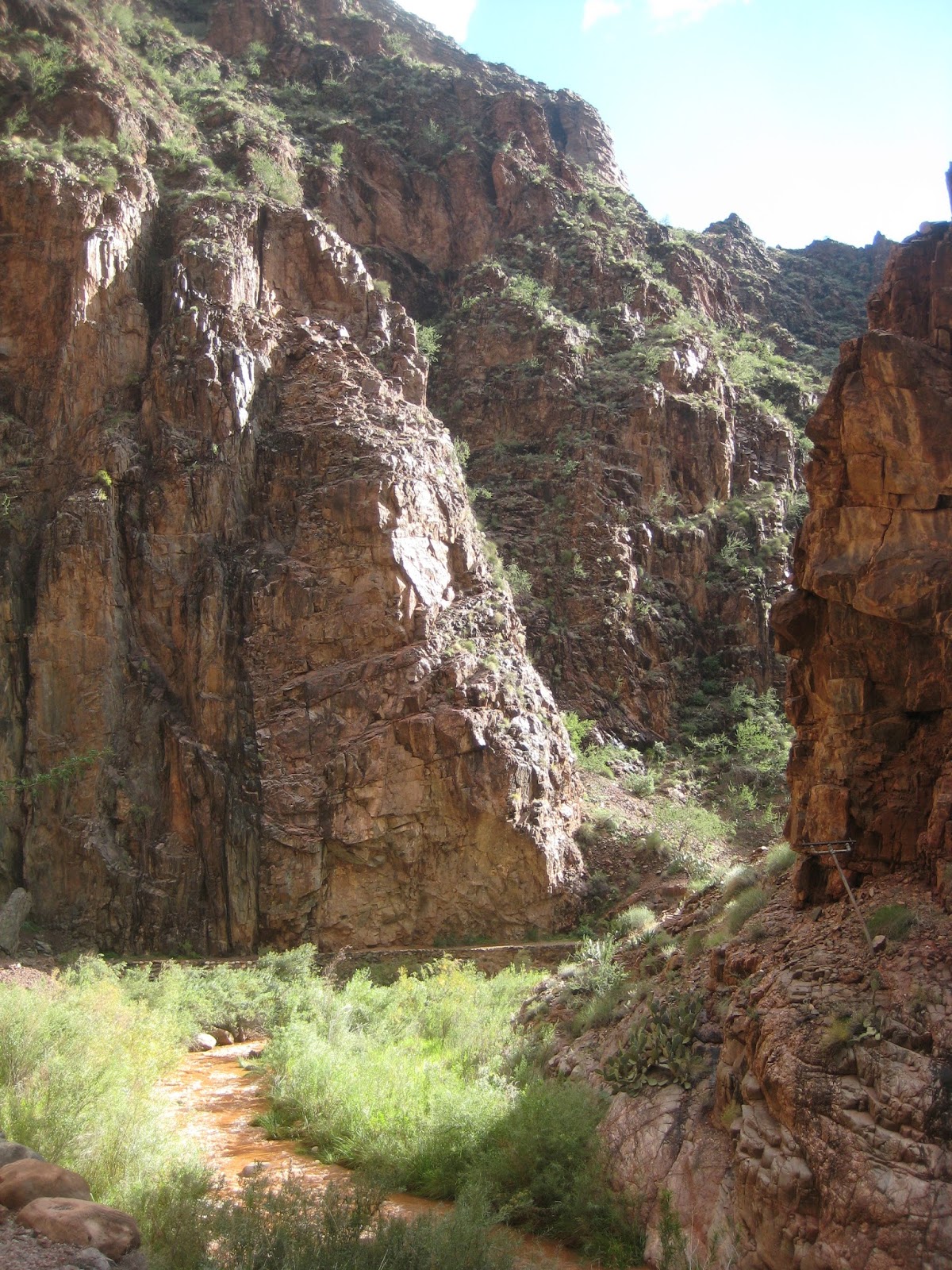
After fifteen minutes, we were back on the trail and soon passed Tipoff, another spot I was supposed to get information for the earth cache. Again, it was raining and I missed it. From tipoff, the trail makes its final descent to the Colorado. As we dropped, the rain slowed and stopped as we neared the tunnel before the black bridge and we were able to put the umbrellas away for the rest of the day.
It felt good cross the bridge over the Colorado; I was last there four years prior. We checked out some information signs about some Indian ruins and followed a muddy trail to Phantom Ranch where we stopped close to an hour for lunch. I stopped in the canteen for some lemonade. While there, I asked if they had any water bottles since mine had a broken cap. They had a 24 oz. Aquafina bottle. Perfect!
We were back on the trail at quarter of two. Supposedly the water was turned off at Cottonwood Camp. We’d be along Bright Angel Creek the whole way but it was running chocolate brown from all the storms, so I left Phantom Ranch with a bunch.
From Phantom Ranch, we had about seven miles to the Cottonwood Camp campground where we had a permit for the night. The trail follows along Bright Angel Creek. It’s an easy trail, with a gentle grade most all of the way. There’s several bridges that cross the creek and it’s a really enjoyable walk. We stopped several times along the way. We even stopped for water at one place where water was dripping off the rocks along the trail.
 |
| Me and a Muddy Bright Angel Creek (Photo Courtesy of Ron) |
We took a turn to go to Ribbon Falls, but that trail crossed the creek and it was flowing high so we turned back to the main trail. Not quite a half mile farther, there’s another trail to Ribbon Falls that has a bridge over the creek. When we got to it, we decided to skip the trip to the falls as it was getting late and the falls were in the evening shade.
 |
| Rainbow |
 |
| Doe and Fawn in Center |
We arrived at Cottonwood Camp about ten past five and spent a few minutes looking for a good campsite. We picked one but then found another that was a bit nicer so we moved there and set up camp.
I was going through my pack looking for my beanie. I had trouble finding it and was getting worried I forgot to pack it. I did find it, but I had myself quite a scare. Ron called it my, “beanie panic.”
We had dinner and were cleaning up and getting camp more organized when it started to sprinkle so we closed things up and called it a night. I fell asleep to rain spattering on my tarp.
October 22, 2015
Start: Cottonwood Camp, GCNP.
End: Passage 39, mile 11.8 (N 36° 19.963 W 112° 06.167).
Miles: ~18.5.
Yesterday, my camera broke. I took a picture and the memory card filled up and I was unable to delete any old pictures to make room. Sometimes the camera flakes out in high humidity so I was hoping the problem would resolve itself overnight but it hasn’t yet. Hopefully it will sometime during this trip. Today I used my phone’s camera to get pictures but I’ll need to limit its use to save battery life.
Even with the rain last night, things were mostly dry this morning when we broke camp. Also, the water was turned on so I was a bit bummed I carried all that extra water yesterday. We were on the trail at quarter past seven.
At eight, we reached the pump house and I went off to find an informational sign for the Rim to Rim earth cache. I found out the sign was up the trail a bit farther while talking to some geologists that were staying there for a few days. I continued up the trail to the sign where I took a picture of it, then continued to Roaring Springs where Ron was waiting. Roaring Springs comes out of the side of a cliff and roars down to the creek bed below.
 |
| Roaring Springs |
After Roaring Springs, the canyon narrows and the trail starts climbing more steeply. It was difficult to see where the trail would work its way up the cliffs. This part of the trail was tiring but with the sun and clouds the light on the canyon walls was spectacular.
 |
| Photo Courtesy of Ron |
About an hour and a half beyond Roaring Springs, we reached the Supai Tunnel rest area where we stopped. There was a group of four that were resting there too. We had a snack and chatted with them for a while when it started to sprinkle. The rain was just a smattering and we were able to mostly ignore it.
At ten forty, we started the last push up to the north rim. Not quite an hour later, it started raining so we stopped to put on our pack covers and open our umbrellas. At eleven fifty, in heavy rain, we made it to the top where we hid under a kiosk and put on more rain gear. We ate some food while hoping for the rain to stop or at least slow down, but it didn’t. The four we met at the Supai Tunnel also made it up and hid on the other side of the kiosk. By quarter past noon, we had finished eating and were getting cold so we figured we better just suck it up and get on the trail.


It took a while, but it felt good to get warmed up while hiking through the Ponderosa Pines. There was water in the trail and I was really surprised and happy that my socks didn’t get wet. The trail turned onto a dirt road then veered off but we missed the turn and didn’t realize it until we walked a few minutes past it. We could have cut across a meadow to get back to the trail but it looked wet so we just turned around and followed the road back. In the meantime, the rain had stopped so we took a short break and put our rain gear away.
The trail meandered through the forest most of the rest of the day. Sometimes it was single track and other times it would follow a road or close to a road. We stopped for a few breaks to eat and eventually we made it to a cabin near the park’s north entrance. We had some more food there and filled our water bottles from some water containers on the side of the cabin left for hikers.
It was about quarter past five when we left the cabin and followed the trail up a road towards the north rim lookout tower. The sun was low and it was starting to cool off. Not far from the tower, the trail turned off the road and shortly after that we stopped to set up camp in the Aspens. Our plan was to camp legally outside the park but it was starting to get dark and cold and even though it wasn’t a legitimate camping area, it seemed best to stop and camp where we were.
I took a few minutes to find a spot to pitch my tarp. First I changed into some warmer clothes, then set up the tarp. I was concerned that the ground was littered with very wet aspen leaves but that turned out to not be a problem. Once the tarp was pitched, I had dinner then turned in for the night.
October 23, 2015
Start: Passage 39, mile 11.8 (N 36° 19.963 W 112° 06.167).
End: Passage 41, mile 1.8 (N 36° 34.326 W 112° 10.363).
Miles: ~23.6.
It got cold last night. I put on my pants, puffy jacket, and gloves to try to stay warm but was still getting cold, mostly from below. I ended up putting my thin closed cell foam pad on top of my air mattress. That helped a lot but I still wished the foam pad was a bit thicker.
There was a heavy dew last night that was all frozen this morning. There was a thick layer of frost on my tarp and I wasn’t able to shake it all off so it folded thick and wouldn’t fit in the stuff sack. That made for cold hands too.
We were packed up and on the trail at quarter past seven. I was wearing my beanie and gloves to start the day. Fifteen minutes later, we reached the park boundary and the start of passage 40. The morning had been in the shade, but finally the sun was starting to reach the trail and help warm us. At half past eight we took a short break to shed some clothes and have a quick bite to eat.
By twenty of ten, we reached the trail to North Canyon Spring. We didn’t need any water but geocache,
BIGHUNK Adventures 2011, was hidden at the junction so I stopped to find it. I wandered around for several minutes before I finally found it. It wasn’t a difficult hide, it just took me a bit to spot it. The Big Hunk was still in it when I found it and when I left it. After over four years sitting in the cache, it probably wouldn’t taste good.
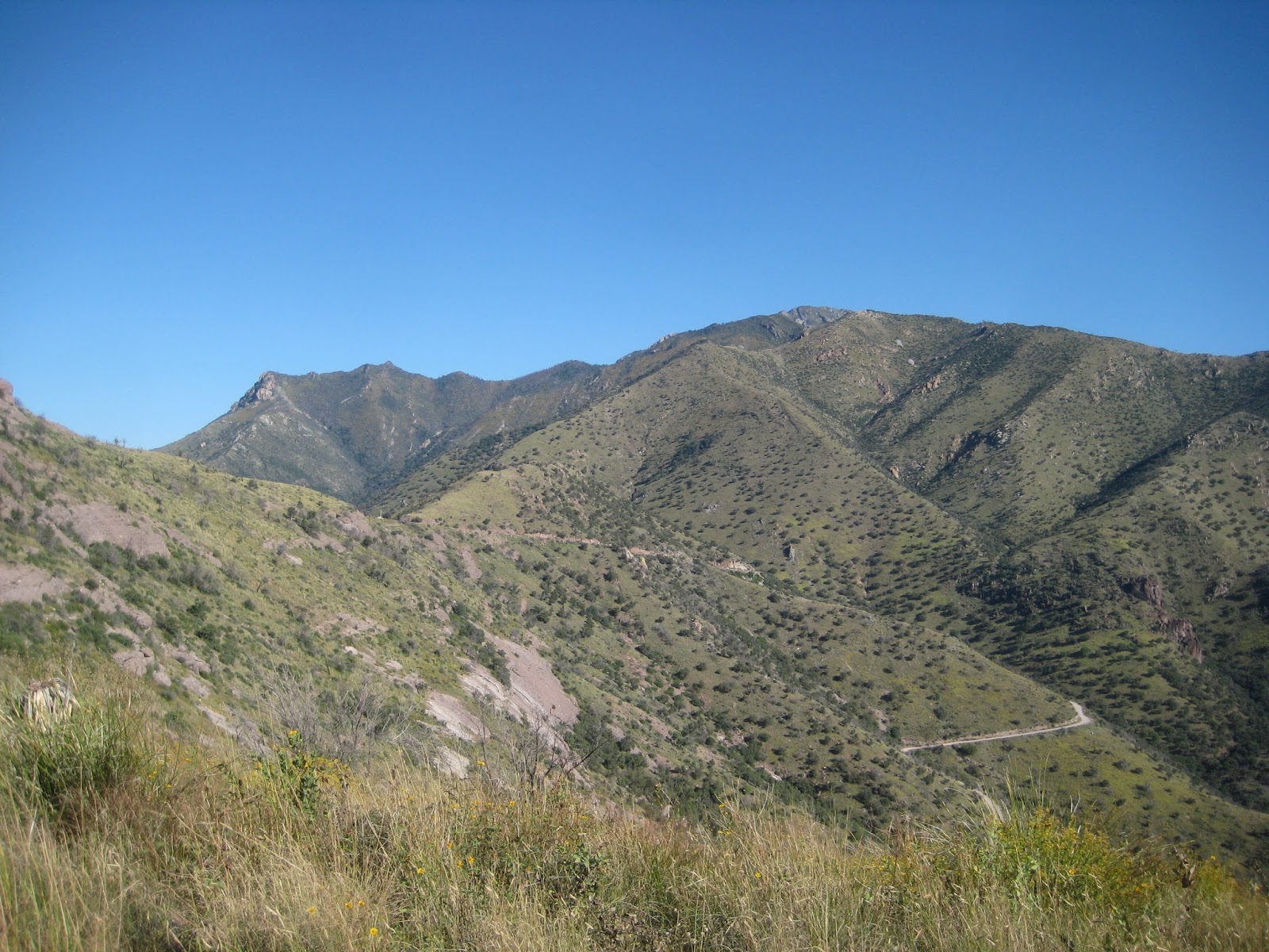
From there the trail climbed up to what is called the East Rim. There were great views of canyons to the east. We could see for miles and miles and it was nice change to the short views we had been having since we reached the north rim.
The views were short lived though as we turned back into the forest after about a mile and soon stopped for a break at Dog Lake. We spent close to fifty minutes at Dog Lake drying out our shelters, getting some water, and having a bite to eat.
It was about half past eleven when we were back on the trail. It wove in and out of forest and open areas. We dropped down some switchbacks and then followed a road along a large grassy area. After a bit, a vehicle with two men pulled up and we chatted with them for a couple minutes before they continued.
By one we were ready for lunch so we stopped in a forested area of the trail to eat. I took my shoes and socks off and got out my food. Ron pulled out one of his salami/cheese/bagel sandwiches and teased me. He didn’t want to trade that for my tuna fish and crackers. Darn.
From there, we hiked for another two hours through the forest and meadows of the Kaibab Plateau before reaching Crane Lake, where we stopped for water. Crane Lake is more like a large pond with lots of reeds, a swampy shoreline, and greenish water. Ron took his shoes and socks off and waded in a bit and filled my bottle for me so I didn’t have to get my feet wet. What a guy! Geocache,
Crane Lake North Rim Cache was across the lake, so I headed over there and found it while eating a Cliff Bar. It wasn’t long before I was back and we finished up getting water and were back on the trail a bit after four.
Not quite two miles from Crane Lake, we left the forest and entered the large burn area from the 2006 Warm Fire. The Warm Fire burned about 59,000 acres, some severely, and is controversial in how the fire was managed. There’s some interesting on-line reading about it.
About ten past five, we crossed FR 241, where passage 40 ends and 41 begins. It was near the end of the day and the temperature was starting to drop. We were looking for a place to camp but with the fire, the ground was all rock and there was tons of deadfall so camp choices were poor at best. We kept walking. There were some hunters across the way, camping off the road. We saw some deer. Every once in a while, there would be some stands of trees but they were never in easy reach. We kept walking. Finally, about ten of six, we came upon a spot that would do, just barely, but it would do.
There was one snag near where Ron was setting up his tent. He pushed on it hard to make sure there was no chance it would fall during the night. I found a place to pitch my tarp and set up my camp. I was cold and had some trouble getting my tarp up. Things just weren’t working out right for me, but finally it was set up and I started dinner.
By the time I finished dinner, the dew was already turning to frost, so I knew it was going to be another cold night. At least I knew what I needed to do to stay warm from last night as I crawled into bed.
I tried my camera a couple times during the day but was still unable to get it to work. I also didn’t want to turn my phone on, so no pictures for today.
October 24, 2015
Start: Passage 41, mile 1.8 (N 36° 34.326 W 112° 10.363).
End: Passage 42, mile 6.2 (N 36° 47.566 W 112° 08.915).
Miles: ~21.6.
I slept pretty good last night, better than I expected to. Despite that, I was slow getting up this morning and it seemed to take a long time to break camp. It was almost quarter of eight when we got on the trail, and as usual, Ron was standing around for a few minutes waiting for me to get my butt in gear. Maybe someday I’ll be quick out of camp but it hasn’t happened yet. Then, barely five minutes later, I stopped to zip off the bottom of my pants. We had another heavy frost last night and the frost is starting to melt in the sun and I’d rather have my legs get a little wet than to soak the bottom of my pants.
We made it another hour and were just leaving the burn section when I noticed we passed geocache,
In the Sticks. I dropped my pack and doubled back to find it. I didn’t find it, but I did find a gallon freezer bag and some wadded up napkins like somebody did their business. I didn’t look too much harder after that and returned to Ron and my pack. I later found out someone took the cache and it’s now archived.
It turns out we didn’t reach the end of the burn, just a small area that wasn’t burnt. We continued on close to four more miles before we finally left the burn for good, a bit before we reached the Murry Lake Trailhead were we stopped for close to half an hour for a break.
It was twenty of eleven when we continued hiking. This stretch of trail paralleled a dirt road where there were several hunters camping. We crossed a hollow where we disturbed a couple of does then we climbed out and crossed next to a man’s campsite. He was just getting into his truck and we mentioned the deer. He knew they were down there and had seen them for the past few days.
Not long after that, we reached Buffalo Trick Tank, our water source for the day. First things first, I found geocache,
Wildlife H2o which was hidden in a stump right there. There was a large metal water tank and below, a hundred yards or more was a dirt cattle tank. We didn’t see an obvious place to get water out of the metal tank, such as a valve, or trough connected to it. There was a lid opening on the top and fortunately, the tank was full so it was easy to get to the water through the lid.
 |
| Photo Courtesy of Ron |
We spent well over an hour at the tank, gathering water, eating, and drying out our shelters from last night’s frost. Again, Ron teased me with his bagel sandwich while I ate my tuna and crackers. We’d also been joking about Cliff Bars just being flavored bear poop. They actually do look a lot like bear poop and really don’t taste much better either. Not that I know what bear poop tastes like, mind you, it’s just that Cliff Bars get old quick.
After the long lunch break, it was about one when we got back on the trail. From there we hiked steadily through the forest talking about whatever came to mind. As we neared the Orderville Trailhead, off of highway 89, I left the trail to find geocache,
Not By the Spoon, while Ron continued to the trailhead. After finding the cache, I cut back to the trail, then started searching for geocache,
Jolly LightFoot, that was near the trailhead. It took me over ten minutes to find. Ron was talking on his phone so I wasn’t super concerned about the length of the search. After finding the cache, I went to the trailhead where I took a short break. A dual-sport rider rode up and we talked to him for several minutes. It was about half past three when we made it across the highway and started passage 42.
From here on, we were walking through forest and were just making miles for the rest of the day. There wasn’t any views, just trees, so we walked. Somewhere when we were about to cross a small road, a truck drove by. The people in the truck waved to us and we waved to them. The interesting thing was that we waved to the same people as they passed by us many miles earlier while we were at the Murry Lake Trailhead.
The trail turned into a road that was recently graded. After a bit, it looked the whole road was newly cut. At any rate, with the new grading, we missed where the trail turned off the road. We had gone maybe a quarter mile past before we realized we weren’t on the trail. I could see where the trail was supposed to be on my GPSr, so we headed cross country to get back on track. We missed maybe a quarter mile of trail, but travelled about a half mile off it. It was sort of like a large isosceles triangle where the trail was one side, and we travelled the other two sides.
Around five-thirty we started looking for a place to camp. There were several reasonably nice spots. We got to a road and decided to go back a short distance to one we had just passed.
We set up camp and had dinner. It definitely cooled off after dark but wasn’t as cold as it had been the last two nights. My tarp was pitched between two trees and there was lots of pine needles for a soft bed. This was my best campsite for the trip and I went to sleep pleased with how things were going.
October 25, 2015
Start: Passage 42, mile 6.2 (N 36° 47.566 W 112° 08.915).
End: Stateline CG.
Miles: ~21.6.
It was warmer last night and drier. There was no dew last night, nor frost this morning. That made breaking camp much nicer as I didn’t freeze my hands folding up my tarp. Ron and I had talked about people stepping out of camp to take care of business and being unable to find their way back to camp when done. It’s just one of those things that happened to come up in conversation. So this morning, I wandered out of camp and took care of business. I thought it would be fun to pretend to get lost so I circled around camp for a bit then yelled. The forest was too open so my stunt fizzled miserably. Oh well. We were on the trail a bit past seven; our earliest start.
The tread was good and the trail was mostly level and descending slightly. It was near the end of the trip so our packs were light. We were cruising along and making good time, covering well over three miles the first hour when we reached the junction for nearby Government Reservoir. We saw a hunter off to the left approaching the reservoir (really just an earthen cattle tank) and bag full of garbage another hiker had left. I’m not sure why, but we left the garbage for the hiker to come and retrieve and took off walking, probably ruining any chance the hunter had for taking any nearby game.
At Government Reservoir, the forest changed from Ponderosa to Juniper and scrub. The terrain stayed flat and we continued to make good time. At half past nine, we’d already walked seven and a half miles and stopped for our first real break for the day because a tendon in my left ankle was getting a bit sore. We sprawled out and had some food and I took my shoes off and rubbed my foot some.
We were back on the trail before ten and about a half hour later, after crossing a small road, I scratched A-Z-T-Y-O-Y-O-G-O-G-O-!!! on the trail for Kathy and Ras Vaughn who were maybe a week behind us attempting the first yo-yo of the Arizona Trail. I didn’t know if rain would wash the letters away or not but hoped they would spot the message.
Just before eleven, we finished passage 42 and stopped for another break. I had developed a small blister on the outside of my left heel and took care of it with a second skin bandage Ron gave me. While there, a BLM ranger drove up and we talked to him for well over half an hour. We’d been seeing tracks on the trail and wondered what they were from. They were small paw prints with very large claw marks. He thought the tracks were probably from a badger. I also found out that I left the driver’s window open on my truck. The ranger seemed happy to know why the truck was parked where it was and lamented me not leaving a note on it.
Interestingly enough, from camp to passage 43 was the same distance as passage 43 was to the end of the Arizona Trail. After forty minutes resting, we were back on the trail starting passage 43, the last passage of the AZT.
We continued for a little over an hour when we stopped for lunch. Again, I wasn’t able to trade my tuna and crackers for Ron’s last bagel sandwich. While we were resting, a man hiked by that was doing day hikes along the Arizona Trail.
For the next hour the trail wandered through junipers and pinon, then funneled into a wash were we stopped to get water. We had just over four miles left until finishing the AZT, but my truck was nine or ten miles farther and we weren’t sure how or when we’d get to it so we made sure we’d have enough for camping another night and hiking to it.
 |
| Wildlife Tank Water Stop |
From there, the trail was washed out from the recent storm as it travelled along the creek bed. That made for slower travel but soon the trail turned out of the wash and reached a ridge where we could see the colored rock of the Vermillion Cliffs. It wasn’t long until we could see the Stateline Campground, the end of the AZT, well below us. The views were spectacular and we excitedly travelled the last two miles of trail that switch-backed about 900’ down to the end of the trail.
 |
| Photo Courtesy of Ron |
 |
| Photo Courtesy of Ron |
We reached the Stateline Campground about quarter past four and took celebratory pictures and congratulated each other and were happy to have completed our hike from Mexico to Utah.
 |
| Arizona Trail Complete |
We hung out for about half an hour trying to figure out what to do. We decided that we would start walking to the truck and hopefully we’d get a ride. We also figured odds were better to get a ride from the Wire Pass trailhead than the empty campground. It was about two miles to the Wire Pass Trailhead. There were some people there that were dropped off by Betty’s Shuttle Service and they said the shuttle service would be coming back later. We were thinking of just night hiking the rest of the way but figured we’d eat dinner first. Some more people stopped at the trailhead for their hike the next morning. A man from the BLM also drove up and asked how we were doing. We mentioned we needed to get to the truck. He had some business at the campground but wasn’t sure whether he’d need to spend the night or not. If not, he offered us a ride. While eating dinner, the thought of walking the rest of the way seemed less and less appealing so we were leaning on camping at the trailhead if we weren’t able to get a ride. Well after a bit, the BLM guy came back and we got the ride.
 |
| Heading to Wire Pass Trailhead |
Once back to the truck, we changed out of our dirty hiking clothes and headed to Page where we got a hotel room for the night. Once settled into the room, we went to restaurant and had another dinner and a beer before crashing for the night. It was great to be cleaned up and fed and have a comfortable bed.