November 21, 2014
After work, I drove to the Temporal Gulch trailhead of passage 4 where I threw out a cot and went to sleep. Along the way, I cached water along the trail in three places. First I placed three liters at the passage 6/7 junction. The road was a bit rough getting there; four wheel drive was helpful but it wasn’t too bad. Next, I placed a gallon where the trail crosses FR 231 along passage 6. Finally, I placed three liters where the trail crosses FR 62 along passage 5.Shortly after placing the water at FR 62, I stopped and found Box Canyon Cache that was just off the road. Along the way from there to Patagonia, I also found virtual cache Rule Britannia!
By the time I reached the Temporal Gulch trailhead it was fairly late and I was ready for bed.
November 22, 2014
Start: Patagonia, SE corner of 3rd and McKeown (N 31° 32.437 W 110° 45.158).End: Off the AZT above Bear Spring (N 31° 40.599 W 110° 48.673).
Miles: ~16 miles.
 |
| Happy to be on the trail, a couple miles outside of Patagonia. |
I parked at the SE corner of 3rd and McKeown, finished packing my pack and getting trail ready. I sent a text to my wife and daughter letting them know where I parked. They spent today driving to Patagonia and shuttling the truck to the Gabe Zimmerman trailhead, my destination 62 miles away. It’s great to have their support on this venture.
I wanted to get started before eight but didn’t get going until 8:10. It seemed strange starting the hike walking through Patagonia but I was happy and excited to begin. It didn’t take long to leave Patagonia behind and head up FR 72 towards Temporal Canyon. The views of the rolling hills and grasslands were spectacular.
Around 9:40, I stopped for a fifteen minute break alongside the road. I shed my long sleeve shirt and had a snack before continuing on to the Temporal Gulch trailhead. At the trailhead, I grabbed the water and Gatorade I stashed and walked a bit farther to a nice place along the creek to take a short break and get the water situated. While there, I drank about half the Gatorade and had another snack. I dumped out about a liter of the four and put the rest in my pack. There was lots of water around so I really should have dumped it all but I didn’t know what the water situation would be further up the trail. From there I hiked a short distance farther and stopped to find the Temporal Canyon geocache.
After finding the cache, I continued up Temporal Canyon for a bit over an hour before stopping for lunch. Here I took my boots and socks off, ate, and read for a while. It was very nice out. Shortly after my lunch break, two men day-hiking passed me on their return. We chatted for a bit and they mentioned that there was a family camping up the hill where they turned around. They also mentioned the hill is steeper than it looks. So far, my hike’s been up hill, but it has been a fairly gradual ascent. That will be changing soon.
After my last two backpacks in Grand Canyon, the climb didn’t seem too steep but it definitely got my heart pumping faster. I was glad for the chance to catch my breath when a Border Patrol agent drove up and asked if I’d seen anything suspicious. Nope, nothing suspicious at all. He drove a bit farther up the hill and stopped to get through a gate. That worked out nice as he held the gate open for me as I plodded on by. Finally I crested the hill and descended to the Walker Basin trailhead where I dropped my pack and searched for The Pools geocache. I wasn’t able to find it and it’s probably gone as others haven’t been able to find it lately either.
After a quick snack, I continued up the trail to the saddle, the highpoint of passage four. I followed the trail around the hill to the east, but when it turned down and to the west, I went off trail continuing along the ridge to the east to find the Walker Canyon in AZ geocache. Once off trail the going was tough and slow. There was lots of brush and trees to work through and the size of my backpack made it more difficult. My hope was to find this and then head down the hill and camp at Bear Spring but the going was slow so I kept my eye open for a good place to camp and found a nice level area in a small saddle above Bear Spring. All along this way, I was following a fence line. The fence was down in a lot of places so I crossed over it several times working my way through the brush and trees. With less than two tenths of a mile from the cache, I hung my pack in a tree next to the fence and started the last climb to the first stage of the cache. Once on top, it didn’t take me long to find the stage and gather the information for the final stage of the cache. By then, it was close to sunset so I hurried back to my pack and then went to the campsite and set up camp for the night.
After the cold last night, I was prepared for another cold night, especially since I was a couple thousand feet higher. It didn’t get near as cold and I was comfortable cooking dinner and enjoying the stars. It was dark, a new moon, so the stars were out in force. I was tired from the day’s hike though, so I moved into my tent early, read for a while, then turned the lights out and closed my eyes for the night.


November 23, 2014
Start: Off the AZT above Bear Spring (N 31° 40.599 W 110° 48.673).End: Below Granite Mt., just shy of passage 5, mile 5.5 (N 31° 45.170 W 110° 45.790).
Miles: ~12 miles.
I don’t recall what time I woke up this morning but it did take longer than I thought it would to eat breakfast and break camp. I finally put my pack on about a quarter after eight and headed towards the final for the Walker Canyon in AZ geocache. The last bit to the final was up a hill that I would come back down on so I hung my pack in a tree and went to look for the final. I looked and looked and wasn’t able to find it. That was a big disappointment as it was the cache I most wanted to find on this trip. I spent too much time looking and reluctantly quit as I was falling behind schedule. By the time I got back to my pack and started heading down the hill towards Bear Spring, it was half past nine.
 |
| First night's camp. |
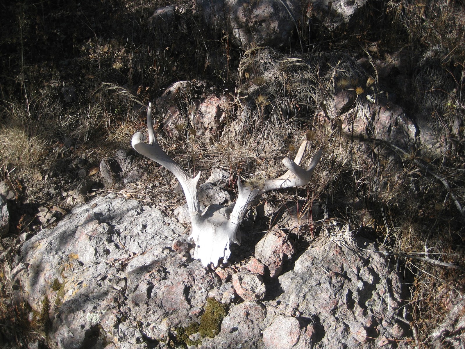 |
| Deer skull on way down to Bear Spring. |
At ten, I reached Bear Spring and the Arizona Trail. I came out of the trees to the trail, right where a man was sitting on a fallen tree. What a surprise for both of us. I introduced myself and we began a nice conversation. I sat on the tree too and we talked for quite a while. It turns out he’s a geocacher and is section hiking the AZT, though in smaller bits than I. His geocaching handle is lodestone. He gave me his card and said to give him a call if I was down this way and was looking for someone to have a beer with.
At twenty past ten, I hit the trail. It was awfully nice to be out of the brush and hiking on good tread. The trail was fast here and I made really good time. A bit over an hour later, I stopped to find The Tunnel at Tunnel Spring geocache. Here was the first of several interpretive signs about past mining operations in the area, along with a trough full of water. While dropping my pack, I heard some grunting noises. It turns out there was a javelina rooting around up a draw about twenty-five yards away from me. I was able to get a couple pictures of it as it moved away. After finding the cache, I put on some sunscreen and got some food to eat before continuing.

 |
| Javelina. |
Soon, the trail turned onto a road. It was forested and I saw a couple pairs of white tail deer as I travelled along it. About forty minutes later, I stopped to find geocache Bear’s Garden of Fun. The trail crossed a creek near the cache, so I dropped my pack there as it would make a nice place for lunch. After finding the cache, I took my boots off and rinsed myself and my shirt in the creek, then I ate lunch while reading. A couple of mountain bikers rode by. I said hi, but they just quickly acknowledged me and went on. I probably stayed here too long but I was enjoying the book and the gurgling creek.
 |
| Remnants of an old dam. |

 |
| Pipeline. |
From the creek, the trail turned into single track and there were more interpretive signs. After a bit, I turned off the trail and went over a small hill and found geocache She wanted to go FAST! Next, I continued a short distance down Gardner Canyon Rd and found OP50 Cave Creek. From there it was about a quarter mile walk along another road back to the Arizona Trail and by 2:40 I finally reached the end of passage 4. There were several campers packing up and I was unable to see which direction the trail went so I asked one which way the trail went. It was on the other side of their vehicles and was easy to follow once I could see it and I was soon working my way up the hill near the start of passage 5.
As I continued towards Kentucky Camp, the temperatures slowly cooled to where my arms were getting chilly and I felt I had to keep moving to stay warm. Eventually, I arrived in a low grassy area as I neared geocache KY in AZ. I broke off the trail to find it. That took a few minutes longer than I thought it would as my GPSr was pointing about 50’ off from where I eventually found it. By then it was about 4:00 pm and I was cold and concerned about making it to my planned finish. I didn’t put long sleeves on as I would be stopping shortly at Kentucky Camp to get water, so I just donned my pack and took off.
 |
| Nearing Kentucky Camp. |
Soon I was at Kentucky Camp. I put on a long sleeved shirt, got water, and took some pictures then started to head out. As I was leaving, my feet seemed sore so I decided to stop and take my boots off for a bit and eat some too. I sat at a picnic table at the cabin and did so. It was nice being at a real table on a real bench. I would have liked to rest longer but it was late in the day and there wasn’t a lot of hiking light left.
 |
| Entering Kentucky Camp. |
 |
| Kentucky Camp. |
 |
| Kentucky Camp. |
I left Kentucky Camp heading out on some single track instead of the road. I think the trail now goes on the single track, but I don’t know. Anyhow, after a bit, the trail reached a road and I turned right instead of left. About three or four tenths of a mile later the trail turned right and back to Kentucky Camp. I wasn’t happy about making the wrong turn, especially since I was hoping to reach my planned stop for the evening. I should have known too, since I was planning on camping below Granite Mountain and there was no mountains the direction I was heading. I turned around and headed back up the road and continued on until I reached a nice place to camp around dark.
The wind picked up as I was setting up camp so I added a guy line to help keep the tent stable. Once the tent was up, I decided to sit in the shelter of the tent while preparing and eating dinner. It was cold out and I had no desire to sit in the wind. After dinner, I sat in the tent and read for a while. I had on all my clothes and even my gloves to help keep warm. At 8:30 I turned the lights off and closed my eyes.
November 24, 2014
Start: Below Granite Mt., just shy of passage 5, mile 5.5 (N 31° 45.170 W 110° 45.790).
End: Wash, passage 6, mile 9.3 (N 31° 53.219 W 110° 41.971).
Miles: ~17 miles.
 |
| Second night's camp. |
 |
| Me and Granite Mountain. |
I woke up later than anticipated this morning, it was close to seven. It was cold too; my water started icing up during the night. At least it was calm; there was no wind to speak of. By the time I ate and broke camp it was about 8:20. There was a cache nearby, Granite Mtn. – AZ Trail. I wanted to look for it yesterday but I was too far behind schedule. I figured it would take around 45 minutes to an hour to detour and find the cache. I also figured I had about 34 miles left so I wanted to get as much distance covered today as I could and couldn’t afford the side trip. Too bad I didn’t get up earlier and get on the trail sooner.
About 50 minutes later, I reached the high point of passage 5. The views were spectacular. The grass was golden and stretched for miles along rolling hills with mountains well off in the distance. It is big, grand country. That’s the best way I can describe it.


A bit after two hours of hiking, I reached FR62 or Box Canyon Rd, where I had stashed three liters of water. It was time for a break. I first found the nearby geocache, AZT in Box Canyon. Next I took my boots and socks off and hung them on the trail gate to dry along with my shirt. I had a snack and read a bit before getting back on the trail, about 50 minutes after I arrived. I didn’t need any of the water I cached, so I left it by the gate for some other hiker.
About twenty minutes later, I stopped to find the cache, Where Does it End? It was right on the trail but it took me a minute or two to figure out where it was hidden. Another forty minutes and I reached the end of passage 5 and the start of passage 6. For the next hour, I continued the hike towards Helvetia Rd or FR 231. Along the way, I passed near the Troll geocache. It wasn’t far but I would have to cross over a couple hills to get to it so I left it behind.

 |
| Where does it end? |
I stopped for lunch at Helvetia Rd. I had a gallon of water that I stashed there. I drank about a quart of it there and packed the rest for later. Again I took my boots and socks off and hung them to dry. I had lunch and sat and read for a while too. More vehicles drove by than I figured would. A semi even drove by. There must be some construction or something going on up the road.
After an hour and ten minute lunch break, I got back on the trail at 2:45. Fifty minutes later, as I was descending to cross a small wash, I saw a couple of other backpackers heading towards me. It turns out they were thru-hiking the Arizona Trail southbound. Their names are Bruce and Deb and are probably a dozen or so years older than I am, though I really don’t know. We had a really nice conversation for about ten minutes and talked about their trip and mine too. I told them about the water I left at Box Canyon Rd. I really enjoyed meeting them and kick myself for not getting a picture of them or one of the three of us.
After that, I hiked the rest of the day except for a ten minute break for a snack and to get the pack off my back. I was hoping to make it to mile 10 of passage 6. I had the time, but the terrain was fairly rugged and rocky. I decided I would stop at the first reasonable place to camp I came across after quarter after five. Ten after five, I crossed a wash with a perfect sandy and flat spot to set up my tent. It was too good to pass so I called it a day. I cut a few branches off a cat claw to give me some more room and pulled some grass from the sand. If there was a threat of rain, I wouldn’t have camped there but there wasn’t so I was fine with pitching my tent in the wash. It was a really nice night and I enjoyed dinner and read for a time before turning out the lights, again at 8:30 pm. This time, I set my alarm for 6:30 am.


November 25, 2014
Start: Wash, passage 6, mile 9.3 (N 31° 53.219 W 110° 41.971).
End: Gabe Zimmerman TH (N 32° 0.846 W 110° 38.859).
Miles: ~17 miles.
Even with setting my alarm for 6:30, I still wasn’t able to get on the trail until a bit after eight. I thought I could get going in an hour but it took over an hour and a half. No problem though, as I started hiking only a few minutes later than I wanted.
 |
| Last night's Camp. |


 |
| Twin Tanks. |
 |
| Trail Magic. |
 |
| Lunch Break. |


 |
| Graffiti. |
As I neared the finish, I stopped and found geocache CIENEGA TRAIL – New Horizons. I was tired and it was so close to the finish that I almost passed it by as I just wanted to be done. Fortunately, I spotted the cache right away. A minute or two after that, I was at the Gabe Zimmerman trailhead. What a feeling to be done, to have hiked from Patagonia to here, I felt very satisfied!
I walked across the parking lot to my truck. I got the keys and opened the door, got a soda from the cooler and sat down and relaxed. I was done, my energy drained from me, my legs stiffened up. After a bit, I cleaned off and took some more pictures and headed out. I was hungry for food, but I was also preparing in my mind for the next hike.

 |
| Gabe Zimmerman Trailhead. |