Monday, November 21, 2016

GCNP - Deer Creek & Thunder River

Deer Creek Falls

In late September, I noticed on Hike Arizona (HAZ), someone advertising a couple spots for a three day backpack trip to Deer Creek and Thunder River in Grand Canyon National Park for the end of October. I was familiar with the trail from a trip there in early November, 2014. I enjoyed that trip and I knew my daughter wanted to hike the canyon again, so we signed up.

Tuesday, September 27, 2016

Yosemite Quicky

After completing the Tahoe Rim Trail, I stopped in Yosemite for a quick overnight outing. I'd never been to Yosemite before so I was excited for this side excursion on my way home. I didn't go to Yosemite Valley, but to Tuolumne Meadows as it was only a short detour over Tioga Pass on my drive from South Lake Tahoe home to Phoenix.


September 13, 2016

0.9 miles. Tuolumne Ranger Station to the Backpacker section of Tuolumne Meadows campground.

I seem to have woken up with a cold. I didn't sleep well and I have a bit of a headache. I took my time getting out of the hotel doing various things.

After checking out, I went to Safeway and got some cold medicine and some food for the trip home. I filled up the tank and stopped at Subway where I got a foot long BMT.

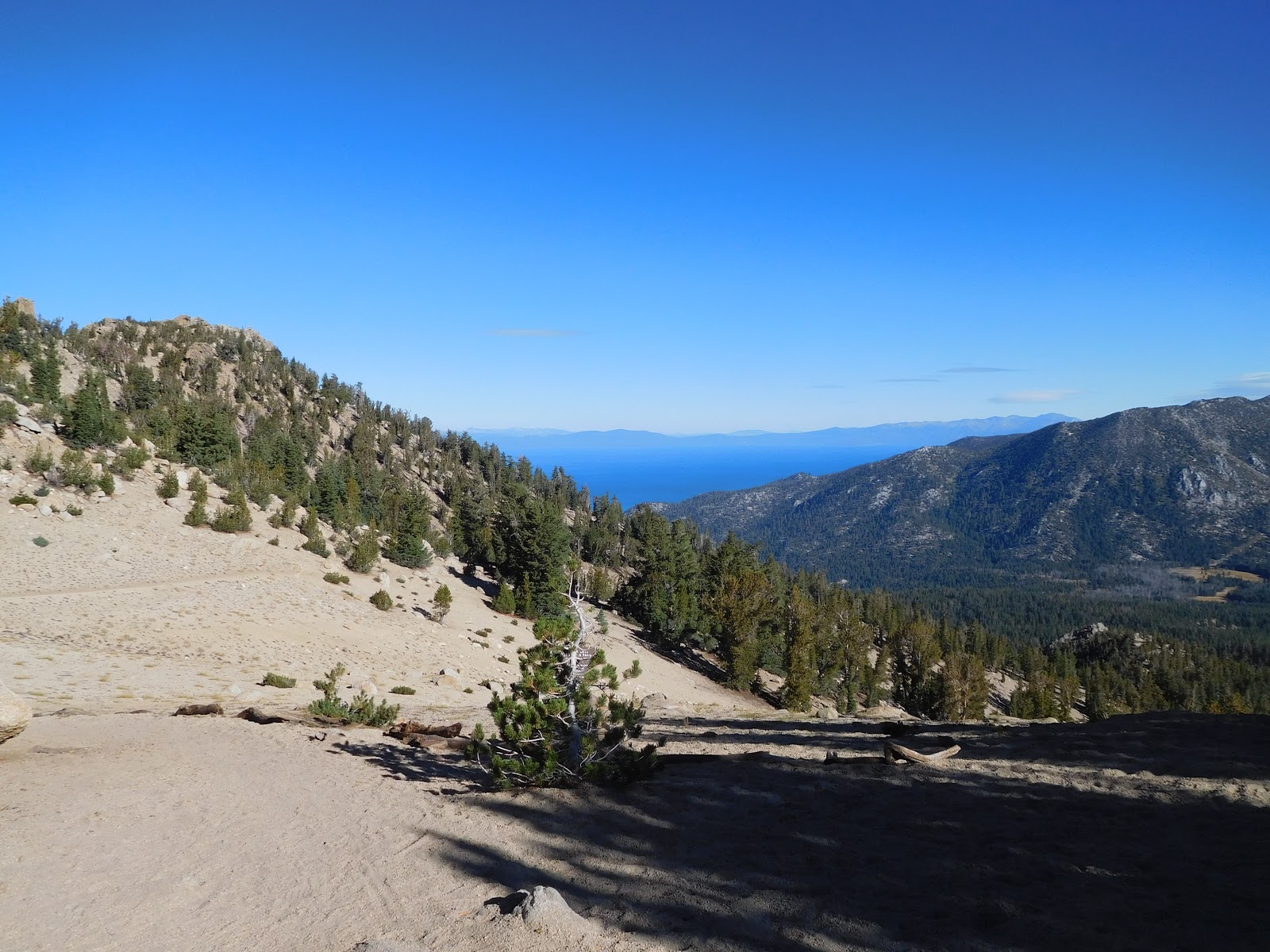
I drove mostly straight through to get to Tuolumne Meadows. I pulled over at some historical marker where I ate lunch. Along the way I stopped for a virtual cache of Mona Lake. I also stopped for an earth cache at Tioga Pass. It was lightly snowing there.

At the Wilderness Center, I got a one night permit. Tomorrow I hike up Rafferty Creek and camp somewhere by Vogelsang. The next day I hike out via Lyell Canyon along the JMT/PCT. It should be a good hike; I'm looking forward to it.

After getting the permit, I got my pack all ready and put food and smellables from my stuff in a food storage box. Next, I walked to the Tuolumne Meadows Backpacker campground and set up camp.

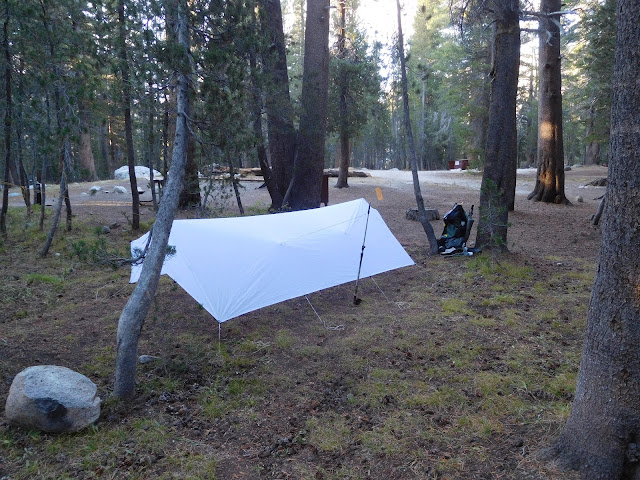
Tuolumne Meadows Camp

I went and listened to the campfire program, The mountains are calling and I must go. It was pretty good but I was getting a bit cold near the end. After it was over I warmed up for a few minutes by the fire instead of heading back to camp.

On the way back to camp, I ended up stopping and sharing a campfire with several people. I was given a PBR too. Yes! The campfire was at a German couple's campsite, Pascal and Kiera. There was also a Spanish couple there that were touring around. There were two PCT sobos there too, Siesta and Chopper. They both started with Solar Body, whom I met on my TRT hike several days before at Dicks Pass. A bit later, another PCT sobo hiked in and joined us. His trail name was Abandoned. It was really nice to be able to socialize after so much lone time and it really boosted my spirits.


September 14, 2016

17.4 miles. Tuolumne Meadows campground to Rafferty Creek trail to Vogelsang High Sierra Camp to Vogelsang Pass, back to the High Sierra Camp then to Evelyn Lake Trail to the JMT at Lyell Canyon.
Total miles: 18.3.

It was cold last night. I wore most all of my clothes to bed, including my gloves.

I was slow getting up since I didn't have a big day planned. It ended up being a lot more than anticipated but I'm happy with that since I'll have less to hike tomorrow and I'm ready to get home.

I started up the Rafferty Creek trail. There was no views and I was questioning why I was doing this. I was tempted to turn back and head home. I felt weak and sluggish too, probably from my cold.

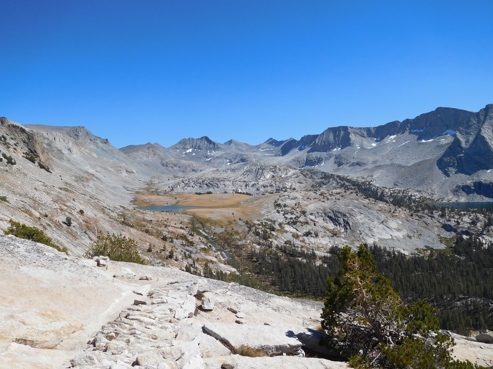
Once I made it out of the forest the views opened up and things got much better for me. When I made it to the Sierra High Camp, I decided to go to Vogelsang Pass. It took me about an hour and a half to go out and back but it was worth it, the views were excellent!

I was going to camp at Evelyn Lake, but when I got there I decided it was too open and exposed for that altitude so I continued to Lyell Canyon instead. It was around four miles farther but I had plenty of time. It was also about 1600' lower too. It won't get nearly as cold where I'm camped now too.


Rafferty Creek Trail

Looking Back Along Rafferty Creek Trail


Looking Down Towards Boothe Lake

Mule Train Above Vogelsang High Sierra Camp


SE View From Vogelsang Pass

Southern View From Vogelsang Pass

SW View From Vogelsang Pass

Vogelsang Lake

Vogelsang Lake


Evelyn Lake Trail

Evelyn Lake


Looking Over Lyell Canyon


September 15, 2016

6.3 miles. Lyell Canyon, along the JMT to Tuolumne Ranger Station.
Total miles: 24.6.

I cowboy camped last night and there was a bit of frost on things this morning. I slept okay but had to get up four times to pee. What's with that? It seems when it's colder I have to get up more.

It was an easy walk out to the Wilderness Center where my truck was parked. I worked on two earth caches and I saw two does and two fawns. That was pretty cool. I finally managed to get a picture of the ubiquitous chipmunks, they're everywhere but they are shy and skittish.

Lyell Canyon

Lyell Canyon

Tuolumne River

Find the Chipmunk


After I got back to my truck, I went to the visitor center, then to the Tuolumne Grill. Lunch wasn't quite ready so I went to Soda Springs for another earth cache, then back to the grill for a burger and fries.

Soda Springs

From there, I would head to Death Valley today, then home tomorrow. I'm looking forward to getting home.

Sunday, September 25, 2016

TRT Day 9, Back to the Start

September 12, 2016
158.6 to 173.0 for 14.4 trail miles.

I could hear the wind blow through the trees all night but I was fairly sheltered where I was camped. It was windy this morning and throughout the day too. I heard a weather system was moving in.

I started the day dropping down to Armstrong Pass. There was a couple coming up. They had a rough night with the wind but were in good spirits since they would be finishing up their TRT section hike today when they reach the Big Meadow trailhead.

From Armstrong Pass I had a long climb up to the Freel Peak trail junction. This was my big obstacle for the day. Early on the way up, I met a man with the TRT Association. He mentioned that the TRT Association Annual Thru Hike Program group was at Star Lake this morning so I would see them on the trail. It was a big group and we passed near the junction. Several of them had radios so they knew I was finishing up my thru today so I got some congratulations.


The sun was glittering off of Star Lake as I dropped down to it. I gathered a liter of water out the lake's outlet but ended up never using it. At least I did dump half of it a few miles before I finished. I did use all the other water I had before I finished though, so it wasn't so bad to carry it. There were a few other water sources though, so I could have waited.


While at Star Lake, I stopped to find a geocache. It was a bearing projection type of thing and I wasn't sure if the bearing was from true north or magnetic north. I guessed wrong but at least the two possibilities weren't that far apart.

I stopped to find a couple more geocaches. The first I also stopped for lunch. The next one I didn't find. I almost passed it by; I wish I did. From there, there were great views off to the west as I descended.


There was one pretty steep climb up a road in a ski area. Once at the top, I found another geocache with a great view, then continued. As I neared the trailhead junction, there was one more geocache just off the trail that I found. It was at a switchback with a bench. I sat at the bench for a couple of minutes enjoying the view knowing that I would complete the trail in just a few minutes time.

Geocache View

Bench View

I got to celebrate completing the trail twice. First at the trail junction to the parking lot where my truck was. I had completed the TRT at that point, so that was exciting. Then, from there I had about a half mile to reach the trailhead where I got to celebrate finishing a second time, celebrate being off trail!

TRT Day 8, Big Meadow

September 11, 2016
137.5 to 158.6 for 21.1 trail miles.

I woke up to the sunrise peaking through the trees. It made for a nice picture and I posted it on Instagram.

Sunrise

View From Bed

There was another campsite a bit up the trail from where I camped. I almost camped there last night and I'm glad I didn't since there was a couple camped there when I went by.

After finishing the climb I ended on yesterday, the trail was forested and nice. There were streams regularly too. When I reached Showers Lake, there was a youth group packed up and getting ready to hike out.


Showers Lake

I met two women on the trail. A mother and daughter. The mother was working on finishing up the PCT. She started a thru last year but life took her off the trail. This year she has been section hiking what she didn't do last year and now she's almost done.

Shortly after talking to the women, I reached where the TRT leaves the PCT. I really enjoyed hiking 50 miles of the PCT!


Goodbye PCT


When I reached Round Lake, I stopped to find a geocache. There was a mountain biker there that asked if I was doing the 165. When one has hiked all of the TRT, one is a member of the 165 club, so I replied yes. He lamented how one can only ride about 100 miles of the TRT instead of all of it.
I stopped for a geocache at Big Meadow, then stopped for water at Big Meadow Creek at the other side of the meadow. A little after that I stopped for lunch, then not long after that I stopped to empty my trash and used TP at the Big Meadow trailhead. Needless to say with all the stops I wasn't making good time.

Round Lake

Round Lake

Looking Back Across Big Meadow

After the Big Meadow trailhead, there was a big climb. I stopped for water and had to fill up for a nine mile dry stretch that included the rest of the big climb. I had only covered 15 miles and it wasn't looking good for me making my planned 22.

Along the way up, when I was setting up to take some video, I met a backpacker going the other way. He was hiking a section of the TRT to see what it is like for a possible future thru-hike. He recently moved from Detroit to Sacramento. He asked how much my pack weighed. I said I think maybe thirty with the full load of water I had. He said his was fifty. Ugh.


I actually made pretty good time up the hill and found two geocaches along the way. It was getting windy and colder and was sunset when I stopped for the night. I found a place a bit lower from the trail and out of the wind to spend the night.


Sunset with Lake Tahoe in the Background