Showing posts with label Tahoe Rim Trail. Show all posts
Showing posts with label Tahoe Rim Trail. Show all posts
Monday, February 26, 2018
Tahoe Rim Trail - My Videos
I know, it's been close to a year and a half since my through hike of the Tahoe Rim Trail but I finally put together three videos of that trip. It was really fun for me to go through the pictures and video I took on that trip. None are too long; all three combined are less than 15 minutes. I hope you enjoy them.
Sunday, September 25, 2016
TRT Day 9, Back to the Start
September 12, 2016
158.6 to 173.0 for 14.4 trail miles.
I could hear the wind blow through the trees all night but I was fairly sheltered where I was camped. It was windy this morning and throughout the day too. I heard a weather system was moving in.
I started the day dropping down to Armstrong Pass. There was a couple coming up. They had a rough night with the wind but were in good spirits since they would be finishing up their TRT section hike today when they reach the Big Meadow trailhead.
From Armstrong Pass I had a long climb up to the Freel Peak trail junction. This was my big obstacle for the day. Early on the way up, I met a man with the TRT Association. He mentioned that the TRT Association Annual Thru Hike Program group was at Star Lake this morning so I would see them on the trail. It was a big group and we passed near the junction. Several of them had radios so they knew I was finishing up my thru today so I got some congratulations.


The sun was glittering off of Star Lake as I dropped down to it. I gathered a liter of water out the lake's outlet but ended up never using it. At least I did dump half of it a few miles before I finished. I did use all the other water I had before I finished though, so it wasn't so bad to carry it. There were a few other water sources though, so I could have waited.


While at Star Lake, I stopped to find a geocache. It was a bearing projection type of thing and I wasn't sure if the bearing was from true north or magnetic north. I guessed wrong but at least the two possibilities weren't that far apart.
I stopped to find a couple more geocaches. The first I also stopped for lunch. The next one I didn't find. I almost passed it by; I wish I did. From there, there were great views off to the west as I descended.


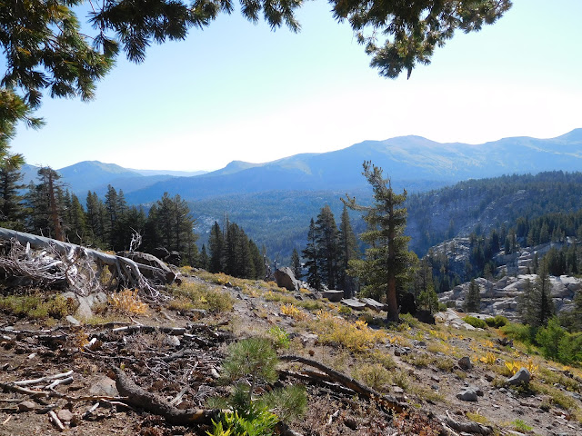
There was one pretty steep climb up a road in a ski area. Once at the top, I found another geocache with a great view, then continued. As I neared the trailhead junction, there was one more geocache just off the trail that I found. It was at a switchback with a bench. I sat at the bench for a couple of minutes enjoying the view knowing that I would complete the trail in just a few minutes time.
I got to celebrate completing the trail twice. First at the trail junction to the parking lot where my truck was. I had completed the TRT at that point, so that was exciting. Then, from there I had about a half mile to reach the trailhead where I got to celebrate finishing a second time, celebrate being off trail!
158.6 to 173.0 for 14.4 trail miles.
I could hear the wind blow through the trees all night but I was fairly sheltered where I was camped. It was windy this morning and throughout the day too. I heard a weather system was moving in.
I started the day dropping down to Armstrong Pass. There was a couple coming up. They had a rough night with the wind but were in good spirits since they would be finishing up their TRT section hike today when they reach the Big Meadow trailhead.
From Armstrong Pass I had a long climb up to the Freel Peak trail junction. This was my big obstacle for the day. Early on the way up, I met a man with the TRT Association. He mentioned that the TRT Association Annual Thru Hike Program group was at Star Lake this morning so I would see them on the trail. It was a big group and we passed near the junction. Several of them had radios so they knew I was finishing up my thru today so I got some congratulations.


The sun was glittering off of Star Lake as I dropped down to it. I gathered a liter of water out the lake's outlet but ended up never using it. At least I did dump half of it a few miles before I finished. I did use all the other water I had before I finished though, so it wasn't so bad to carry it. There were a few other water sources though, so I could have waited.


While at Star Lake, I stopped to find a geocache. It was a bearing projection type of thing and I wasn't sure if the bearing was from true north or magnetic north. I guessed wrong but at least the two possibilities weren't that far apart.
I stopped to find a couple more geocaches. The first I also stopped for lunch. The next one I didn't find. I almost passed it by; I wish I did. From there, there were great views off to the west as I descended.


There was one pretty steep climb up a road in a ski area. Once at the top, I found another geocache with a great view, then continued. As I neared the trailhead junction, there was one more geocache just off the trail that I found. It was at a switchback with a bench. I sat at the bench for a couple of minutes enjoying the view knowing that I would complete the trail in just a few minutes time.
 |
| Geocache View |
 |
| Bench View |
I got to celebrate completing the trail twice. First at the trail junction to the parking lot where my truck was. I had completed the TRT at that point, so that was exciting. Then, from there I had about a half mile to reach the trailhead where I got to celebrate finishing a second time, celebrate being off trail!
TRT Day 8, Big Meadow
September 11, 2016
137.5 to 158.6 for 21.1 trail miles.
I woke up to the sunrise peaking through the trees. It made for a nice picture and I posted it on Instagram.
There was another campsite a bit up the trail from where I camped. I almost camped there last night and I'm glad I didn't since there was a couple camped there when I went by.
After finishing the climb I ended on yesterday, the trail was forested and nice. There were streams regularly too. When I reached Showers Lake, there was a youth group packed up and getting ready to hike out.


I met two women on the trail. A mother and daughter. The mother was working on finishing up the PCT. She started a thru last year but life took her off the trail. This year she has been section hiking what she didn't do last year and now she's almost done.
Shortly after talking to the women, I reached where the TRT leaves the PCT. I really enjoyed hiking 50 miles of the PCT!


When I reached Round Lake, I stopped to find a geocache. There was a mountain biker there that asked if I was doing the 165. When one has hiked all of the TRT, one is a member of the 165 club, so I replied yes. He lamented how one can only ride about 100 miles of the TRT instead of all of it.
I stopped for a geocache at Big Meadow, then stopped for water at Big Meadow Creek at the other side of the meadow. A little after that I stopped for lunch, then not long after that I stopped to empty my trash and used TP at the Big Meadow trailhead. Needless to say with all the stops I wasn't making good time.
After the Big Meadow trailhead, there was a big climb. I stopped for water and had to fill up for a nine mile dry stretch that included the rest of the big climb. I had only covered 15 miles and it wasn't looking good for me making my planned 22.
Along the way up, when I was setting up to take some video, I met a backpacker going the other way. He was hiking a section of the TRT to see what it is like for a possible future thru-hike. He recently moved from Detroit to Sacramento. He asked how much my pack weighed. I said I think maybe thirty with the full load of water I had. He said his was fifty. Ugh.


I actually made pretty good time up the hill and found two geocaches along the way. It was getting windy and colder and was sunset when I stopped for the night. I found a place a bit lower from the trail and out of the wind to spend the night.

137.5 to 158.6 for 21.1 trail miles.
I woke up to the sunrise peaking through the trees. It made for a nice picture and I posted it on Instagram.
 |
| Sunrise |
 |
| View From Bed |
There was another campsite a bit up the trail from where I camped. I almost camped there last night and I'm glad I didn't since there was a couple camped there when I went by.
After finishing the climb I ended on yesterday, the trail was forested and nice. There were streams regularly too. When I reached Showers Lake, there was a youth group packed up and getting ready to hike out.


 |
| Showers Lake |
I met two women on the trail. A mother and daughter. The mother was working on finishing up the PCT. She started a thru last year but life took her off the trail. This year she has been section hiking what she didn't do last year and now she's almost done.
Shortly after talking to the women, I reached where the TRT leaves the PCT. I really enjoyed hiking 50 miles of the PCT!

 |
| Goodbye PCT |

When I reached Round Lake, I stopped to find a geocache. There was a mountain biker there that asked if I was doing the 165. When one has hiked all of the TRT, one is a member of the 165 club, so I replied yes. He lamented how one can only ride about 100 miles of the TRT instead of all of it.
I stopped for a geocache at Big Meadow, then stopped for water at Big Meadow Creek at the other side of the meadow. A little after that I stopped for lunch, then not long after that I stopped to empty my trash and used TP at the Big Meadow trailhead. Needless to say with all the stops I wasn't making good time.
 |
| Round Lake |
 |
| Round Lake |
 |
| Looking Back Across Big Meadow |
After the Big Meadow trailhead, there was a big climb. I stopped for water and had to fill up for a nine mile dry stretch that included the rest of the big climb. I had only covered 15 miles and it wasn't looking good for me making my planned 22.
Along the way up, when I was setting up to take some video, I met a backpacker going the other way. He was hiking a section of the TRT to see what it is like for a possible future thru-hike. He recently moved from Detroit to Sacramento. He asked how much my pack weighed. I said I think maybe thirty with the full load of water I had. He said his was fifty. Ugh.


I actually made pretty good time up the hill and found two geocaches along the way. It was getting windy and colder and was sunset when I stopped for the night. I found a place a bit lower from the trail and out of the wind to spend the night.

 |
| Sunset with Lake Tahoe in the Background |
TRT Day 7, Aloha SOBO
September 10, 2016
117.3 to 137.5 for 20.2 trail miles.
I was on the trail a bit before half past seven and started the climb up Dicks Pass. Near the top, while taking some pictures, I noticed another hiker behind me. At the pass, we introduced ourselves. The hiker's trail name is Solar Body and he is sobo hiking the PCT. He hiked the AT last year and intends to hike the CDT next year.
We ended up hiking together to the Echo Lake trailhead where he hitched into South Lake Tahoe for resupply. I was getting water when he got a ride so we didn't really get to say goodbye.
The trail was so much eye candy today as we really saw the beauty the Sierra has to offer. I think I only covered eight miles the first five hours on trail. We kept stopping to gawk and take pictures and video. I even went for a quick dip in Susie Lake.


After Aloha Lake, there was a long rocky and hot descent to Echo Lake. There were tons of people going up. Then we traversed the lake to where the marina is. I ran out of water just before we arrived but would have drank more if I had it.
The store at the Echo Lake marina closed last week so I wasn't able to get anything to eat like icecream. There were trash containers and an outhouse though so I was able to dump my trash and uded TP before continuing on.
I met a man section hiking the PCT. I think he was heading to Donner Pass on this outing. I also stopped at Echo Summit to look for a geocache but wasn't able to find it. Echo Summit was used as a high altitude training center for the 1968 Olympics. Shortly after that, I met a couple finishing up their PCT thru-hike. They skipped ahead and are hiking where they skipped. I believe they'll finish at Donner Pass.
I wasn't sure if there would be water at a stream near where I planned to camp so I stopped earlier to get water for the night and the next morning. That made my pack a bit heavy on the climb up to my campsite. Along the way there was a couple practicing bouldering. They even had a couple of those pads in case you fall.
Today was long, mostly because Solar Body and I were moving slow this morning with all the lovely scenery. It was getting dark when I arrived at camp. Once at camp, I had cell service so besides dinner and the normal camp chores, I putzed around online for a bit and called Barbara.
Only 35 miles left.
117.3 to 137.5 for 20.2 trail miles.
I was on the trail a bit before half past seven and started the climb up Dicks Pass. Near the top, while taking some pictures, I noticed another hiker behind me. At the pass, we introduced ourselves. The hiker's trail name is Solar Body and he is sobo hiking the PCT. He hiked the AT last year and intends to hike the CDT next year.
We ended up hiking together to the Echo Lake trailhead where he hitched into South Lake Tahoe for resupply. I was getting water when he got a ride so we didn't really get to say goodbye.
 |
| Solar Body and Me |
The trail was so much eye candy today as we really saw the beauty the Sierra has to offer. I think I only covered eight miles the first five hours on trail. We kept stopping to gawk and take pictures and video. I even went for a quick dip in Susie Lake.
 |
| Dicks Lake |
 |
| Looking Back on Dicks Lake and Fontanillis Lake |
 |
| Me and Beyond Dicks Pass |
 |
| Half Moon Lake and Susie Lake |


 |
| Lake Aloha |


 |
| Echo Lake |


 |
| Solar Body Nearing Echo Lake Marina |
After Aloha Lake, there was a long rocky and hot descent to Echo Lake. There were tons of people going up. Then we traversed the lake to where the marina is. I ran out of water just before we arrived but would have drank more if I had it.
The store at the Echo Lake marina closed last week so I wasn't able to get anything to eat like icecream. There were trash containers and an outhouse though so I was able to dump my trash and uded TP before continuing on.
I met a man section hiking the PCT. I think he was heading to Donner Pass on this outing. I also stopped at Echo Summit to look for a geocache but wasn't able to find it. Echo Summit was used as a high altitude training center for the 1968 Olympics. Shortly after that, I met a couple finishing up their PCT thru-hike. They skipped ahead and are hiking where they skipped. I believe they'll finish at Donner Pass.
 |
| Log Water Crossing |
I wasn't sure if there would be water at a stream near where I planned to camp so I stopped earlier to get water for the night and the next morning. That made my pack a bit heavy on the climb up to my campsite. Along the way there was a couple practicing bouldering. They even had a couple of those pads in case you fall.
Today was long, mostly because Solar Body and I were moving slow this morning with all the lovely scenery. It was getting dark when I arrived at camp. Once at camp, I had cell service so besides dinner and the normal camp chores, I putzed around online for a bit and called Barbara.
Only 35 miles left.
Saturday, September 24, 2016
TRT Day 6, Desolation Wilderness
September 9, 2016
97.9 to 117.3 for 19.4 trail miles. Plus a few geocaches.
I slept pretty good last night but still felt really tired this morning; it was hard to get up. I was on the trail at half past seven.
Not long after I started, I went to find a geocache up on a rocky peak. I dropped my pack and went around a rock and there was a set of trekking poles. A bit farther around and there was a woman who had camped on the rock. I should have announced myself when I first saw the poles but didn't think of that. We talked for a minute and then I continued to the top and found the geocache.


I found another geocache near the Barker Pass trailhead. There was a whole bunch in the area but I skipped them.
When I reached Richardson Lake, I stopped for lunch and got some water. I also took my shoes off and washed my feet. That felt great. It was nice to relax for a bit. I noticed two other backpackers a bit farther down the lake but never talked to them. They left just before I did and were heading where I had come from.

Shortly after lunch, I found another geocache that wasn't far off the trail. There was a metal pole about 8' high near it with what looked like an antenna at the top. There was another similar pole near the trail too. I'm curious what they are for; I should have taken a picture of one.
I was pretty excited to enter the Desolation Wilderness. It's supposed to contain some of the best scenery along the trail and is a very popular area. I imagine I'll see more people out today and tomorrow because of it.


I talked to couple going other way. I told them I am doing the TRT and that I was heading to Dicks Lake. As they were leaving, the gal suggested Lake Fontanillis. She said it was near Dicks Lake and was very nice.
I was about to catch up to another couple but needed a drink so I stopped to do filter some water from one bottle to the one I drink out of before I passed them. It didn't take very long to catch back up to them after that. I talked to the man for a minute then continued on.
It seemed to take forever to get to Middle Velma Lake. It was hot and the climb was tiring. Finally I made it. There were lots of people camped around it. I stopped and took a short break before continuing up to Lake Fontanillis. On the way some people that had been doing trail work were heading out. The first one asked where I was sleeping tonight. I said I planned to stop at Dicks Lake. It's nice to know that people like to help maintain the trails.
I really enjoyed walking past Lake Fontanillis. It was very nice, like the one gal said, but the trail was rocky and slow going. I was about out of water so I filled a liter up when the trail crossed the lake's outflow. There were lots of people camped along Fontanillis too. I passed one camp where a very big dog barked at me. I'm glad it was tied up.


Between Lake Fontanillis and Dicks Lake, I ran into another couple with a dog. We talked for a few minutes and the dog promptly lied down. I commented how it was ready to call it a day. They had been out for several days but hadn't gone real far. They do short days with a lot of relaxing.
I made it to Dicks Lake and wandered around a bit looking for a campsite. There's a nice campsite right off the trail but there were a couple men already camped there. They said rumor had it that the best sites were to my left so I went there and didn't find anything so I went back and went to the right and found a nice one. I guess the rumor was wrong.
I went to the lake and got water then went back to my camp and noticed an even nicer spot a short distance away, so I moved there. Then I went back to the lake and washed up a bit before going back and setting up camp and getting dinner. I was able to get all that done before dark. It's nice to not dry camp for once this trip. It's also different to have so many people around.
97.9 to 117.3 for 19.4 trail miles. Plus a few geocaches.
I slept pretty good last night but still felt really tired this morning; it was hard to get up. I was on the trail at half past seven.
 |
| Last Night's Camp |
 |
| Sunrise |
Not long after I started, I went to find a geocache up on a rocky peak. I dropped my pack and went around a rock and there was a set of trekking poles. A bit farther around and there was a woman who had camped on the rock. I should have announced myself when I first saw the poles but didn't think of that. We talked for a minute and then I continued to the top and found the geocache.


I found another geocache near the Barker Pass trailhead. There was a whole bunch in the area but I skipped them.
When I reached Richardson Lake, I stopped for lunch and got some water. I also took my shoes off and washed my feet. That felt great. It was nice to relax for a bit. I noticed two other backpackers a bit farther down the lake but never talked to them. They left just before I did and were heading where I had come from.

 |
| Richardson Lake |
Shortly after lunch, I found another geocache that wasn't far off the trail. There was a metal pole about 8' high near it with what looked like an antenna at the top. There was another similar pole near the trail too. I'm curious what they are for; I should have taken a picture of one.
I was pretty excited to enter the Desolation Wilderness. It's supposed to contain some of the best scenery along the trail and is a very popular area. I imagine I'll see more people out today and tomorrow because of it.


I talked to couple going other way. I told them I am doing the TRT and that I was heading to Dicks Lake. As they were leaving, the gal suggested Lake Fontanillis. She said it was near Dicks Lake and was very nice.
I was about to catch up to another couple but needed a drink so I stopped to do filter some water from one bottle to the one I drink out of before I passed them. It didn't take very long to catch back up to them after that. I talked to the man for a minute then continued on.
It seemed to take forever to get to Middle Velma Lake. It was hot and the climb was tiring. Finally I made it. There were lots of people camped around it. I stopped and took a short break before continuing up to Lake Fontanillis. On the way some people that had been doing trail work were heading out. The first one asked where I was sleeping tonight. I said I planned to stop at Dicks Lake. It's nice to know that people like to help maintain the trails.
 |
| Middle Velma |
I really enjoyed walking past Lake Fontanillis. It was very nice, like the one gal said, but the trail was rocky and slow going. I was about out of water so I filled a liter up when the trail crossed the lake's outflow. There were lots of people camped along Fontanillis too. I passed one camp where a very big dog barked at me. I'm glad it was tied up.


Between Lake Fontanillis and Dicks Lake, I ran into another couple with a dog. We talked for a few minutes and the dog promptly lied down. I commented how it was ready to call it a day. They had been out for several days but hadn't gone real far. They do short days with a lot of relaxing.
I made it to Dicks Lake and wandered around a bit looking for a campsite. There's a nice campsite right off the trail but there were a couple men already camped there. They said rumor had it that the best sites were to my left so I went there and didn't find anything so I went back and went to the right and found a nice one. I guess the rumor was wrong.
I went to the lake and got water then went back to my camp and noticed an even nicer spot a short distance away, so I moved there. Then I went back to the lake and washed up a bit before going back and setting up camp and getting dinner. I was able to get all that done before dark. It's nice to not dry camp for once this trip. It's also different to have so many people around.
Subscribe to:
Posts (Atom)