To help me out, I purchased some new gear to lighten my load. First I got a new sleeping bag, an REI Igneo. Second I replaced my tent with a Tarptent Moment DW. Between the two, I lightened my load by over three pounds. I also got a new hat. A full brimmed OR hat to replace my worn ball cap.
March 30, 2015
Start: Gave Zimmerman TH (N 32° 00.846 W 110° 38.859).End: Rincon Creek, Passage 8, mile 13.9 (N 32° 07.683 W 110° 38.567).
Miles: ~13.9.
 |
| All Ready to Start, Saying Goodbye to my Sweetheart |
This morning Barbara made the drive with me to the trailhead. We stopped at the Costco near Vail for gas and then had an early lunch at Carver’s before going the rest of the way to the trailhead. Once there, I laced up my boots and got ready to go. It was a little warm so I decided not to bring the trail-mix that included M&Ms. It was about ten past eleven when we hugged each other good bye and I started hiking. I was excited to be filling the gap I had from here to Oracle. Not even a minute later, I stopped to find geocache, Cienega Dime - New Horizons. Once that was done, I was really on the trail.
Not long after starting, the trail crossed the riparian area of Cienega Creek. It was very lush and there was a balancing rock cairn. The trail crossed under a railroad track then climbed out of the creek, looped around and crossed a road then went under another train track. Here the trail was under a screen to protect trail users from falling debris from any passing trains. There was a lot of rocks on the screen but I think they were from people throwing them up there, not from falling off passing trains.
 |
| Cienega Creek Riparian |
 |
| Balancing Cairn |
From there, the trail meandered around the desert undulating gently. It was warm but not hot and there were some desert flowers blooming. After being on the trail for about an hour and a half I stopped for a few minutes at a saddle overlooking La Posta Quemada Ranch and sipped on some Gatorade. As I neared the ranch, I saw a couple ride a buggy up a road to the ranch. There were also informational signs about the area and Colossal Cave Mountain Park. An hour later, around twenty of two, I came to the park’s camping area and stopped for about a half hour at one of the campsites where I had some food. There were some geocaches in the park but they were farther out of the way than I wanted to go.
 |
| La Posta Quemada Ranch with Buggy |
It was just over half a mile from there to La Sevilla Picnic Area where I was going to stop again for water. Along the way, I veered to the right to find geocache, Ancient Cliff Dweller....you know. I dropped my pack at a picnic table and climbed up a hill to find it. While at the cache, I could see a couple of hikers go by, followed shortly by two more. They all stopped at the picnic area where the water was. I dropped back to my pack and headed over there too.

When I arrived, we all introduced ourselves. The first two hikers were Dead Animal and The Michigan Wolverine and the next two were Onna Move and Neon. The four of them were thru-hiking the Arizona Trail together. This whole concept of trail names was new to me and it seemed a bit strange and conversation seemed strained at times, but I did enjoy talking to them and resting under the shade of the ramada.
I left first to go find a nearby geocache, Ol' Stinky, hidden by the ruins of an old out house. I was still looking for it when Onna and Neon walked by but was back on trail before the Dead Animal and Wolverine were. Not twenty minutes later, I dropped my pack to find another geocache, It Goes here!, about a tenth of a mile off the trail. When I found it, Animal and Wolverine waved and I held the cache up for them to see.
 |
| Neon and Onna |
After a while, I caught up to Onna who was going a little slower than the others taking pictures along the way. There were various desert wildflowers blooming and the trail was winding around. We all met back up at Pistol Hill Road where we took a half hour break. While there, a man drove by and stopped to talk to us for several minutes. He grew up in the area and told how he used to hike and camp up in the surrounding mountains and he offered us beers too. I passed.

It was about five when we got going again and about three and a half miles to Rincon Creek, where we all planned on camping for the night. We marched off at a good pace. I think we all wanted to reach camp before dark.
As the trail made a turn and dropped to Rincon Creek, we were greeted with flowing water and a nice sandy beach to camp on. It was very nice and we were treated to a wonderful sunset. We soaked our feet and had dinner. I set up my tent and the others cowboy camped. I was surprised how quickly they turned in for the night, so I crawled in my tent and read some before calling it a night.

 |
| Sunset on Rincon Creek |
March 31, 2015
Start: Rincon Creek, Passage 8, mile 13.9 (N 32° 07.683 W 110° 38.567).End: Manning Camp, Passage 9, mile 12.8 (N 32° 12.397 W 110° 33.277).
Miles: ~13.7.
Everybody started stirring around six. Onna and Neon were first to get out of camp around half past and maybe fifteen minutes later, Animal and Wolverine were off. I gagged on oatmeal for breakfast and am not nearly as practiced at breaking camp so I didn’t leave Rincon Creek until almost half past seven.
 |
| Dead Animal and The Michigan Wolverine |
Not far after leaving Rincon Creek the trail enters Saguaro National Park, then winds back and forth and doesn’t seem to get anywhere fast but finally heads north to Hope Camp where there’s an old windmill and water tanks that have long since stopped working and mark the end of passage 8 and the start of passage 9, Rincon Mountains.
 |
| Hope Camp |
The trail follows a wide path for about a half mile before turning right onto single track. The trail meanders along the mountain’s contour for a mile and a half before starting to climb and it was along this way that a Gila Monster crossed the trail in front of me. I’ve had the good fortune of seeing several in the past but it is always a treat to see another. I stopped and watched it lumber around until it got annoyed and asked me to leave.

 |
| Gila Monster |
Not long after the Gila Monster, I came upon Neon and Onna resting along the trail. I was surprised to see them so soon but they missed the turn onto the single track and got some bonus miles in. Soon after, the trail passed some nice pools of water then started its long, arduous climb up Mica Mountain. By half past nine, I was ready for a break and there was a tree next to the trail supplying some welcomed shade so I stopped, pulled off my boots and socks and rested. After a while, Neon and Onna passed by. We ended up leap frogging throughout the day.

 |
| Neon Followed by Onna |
After the break, the climbing was difficult. The batteries in my GPSr died and after I replaced them I decided to take a short break. A wrangler with three pack mules passed me and stopped maybe 50 yards farther at a creek the trail crossed to let the mules drink. Some cool water enticed me to move there. There was a nice pool just up from the trail where I rinsed my face and filtered some water.
My eyes started bothering me and were watering a lot. At first I thought it might be from the sun glaring off the rocks. I figure it was allergies and the glare and sweat from the climb just made things worse. As I neared the Grass Shack campground, it was all I could do to keep my eyes open.

 |
| Pack Mules and Mule Skinner |
 |
| Refreshing Water |
When I reached Grass Shack, the mule skinner was there along with Animal and Wolverine. I was ready to close my eyes and rest them. I got some more water, ate, and took a nap. Neon and Onna showed up too. We were all pretty beat by the climb and we had a long rest. It was about half past two when we got going again.
My eyes were still hurting but the rest helped and they weren’t as bad as before the break. Unfortunately, that didn’t last, especially with the sweat dripping off my brow and the sun’s glare. I went about an hour and fifteen before finding a shady spot for another break. I made it a bit over half an hour before another break and then was able to make one more push to Manning Camp. After Grass Shack, the climbing was pretty intense, but I mostly just remember how much my eyes hurt, how they were watering and I could barely keep them open.
I was glad to reach Manning Camp and found a campsite to set up in. I looked around some and talked with the wrangler. He was packing supplies up for a crew that was going to fix the roof on the Ranger’s building. I filtered some water then joined the others at the helipad where we watched the sunset. I went back to my camp and ate dinner, then went to sleep. It was cold and windy and it was nice to be sheltered in the tent. I didn’t want to read; my eyes were still sore and I just wanted to close them. I wondered about how they would be tomorrow and worried that if they were bad I’d have to bail out.
 |
| Squinting at Manning Camp |
April 1, 2015
Start: Manning Camp, Passage 9, mile 12.8 (N 32° 12.397 W 110° 33.277).End: West Spring Tank, Passage 10, mile 10.8 (N 32° 19.763 W 110° 40.474).
Miles: ~19.6.
 |
| Manning Camp |
It was twenty to eight when I left Manning Camp. My eyes were still sore from yesterday but okay to start. It was brisk and the trail was a soft ribbon through Ponderosa and dried ferns. The trail started off gently but steepened as it neared the top of Mica Mountain. I dropped my pack and took the summit trail to find geocache, Mica Mountain, an old virtual cache. At the summit there was a benchmark and footings for an old lookout tower that has long since been dismantled. I was hoping for a 360° panorama, but the summit was a rounded slope with trees blocking the view. I did the geocaching thing, signed the summit register, and returned back to my pack and the Arizona Trail.
 |
| Near the Top of Mica Mountain |
The trail started its descent down Mica Mountain where I joined Onna and Neon for a short break where the trail left the trees and had an expansive view to the east of mountains and valleys. Not long after that we reached Italian Spring where Animal and Wolverine and another hiker were getting water.


That hiker left and I soon followed down the trail. Maybe ten minutes later the hiker was stopped just off the trail holding a horned toad to his chest. He told me a story of how Indians believe doing so will bring one peace or strength. I’m not sure of the story now. We introduced ourselves and headed down the trail talking about all sorts of things. The hiker was Adam Bradley, holder of the fastest known time (FKT) of the Arizona Trail. He previously jointly held the FKT of the Pacific Crest Trail with Scott Williamson. He was currently on what he called his strange loop, a hiking/cycling endeavor starting the previous June from his home in Reno. The strange loop included hiking the Pacific Crest Trail, Appalachian Trail, Continental Divide Trail, parts of the Arizona Trail and Grand Enchantment Trail and riding a bicycle between them.
 |
| Krudmeister |
We descended down the trail together for over an hour until I stopped to find geocache, Italian Spring Trail. We said good bye and he continued down the trail and I dropped my pack to find the cache. As I neared it, something large busted through the brush. It was probably a deer but I didn’t see whatever it was.
Shortly after finding the geocache, I took a half hour break hiding under the shade of a Juniper. I should have hiked on because not quite a mile farther there was a nice running stream where Neon, Onna, Animal, and Wolverine were hanging out. We all said hi and I continued on. Maybe a mile and a half after that, I met two people walking up the trail, an older Indian man and a younger Indian woman. As I neared, the man asked, “Are you crud?” “Huh, am I what?” I replied. I think he realized what his question sounded like and seemed a bit embarrassed about it. Anyway, it turned out he was asking if I was Krudmeister. I said no and added that I had no idea who Krudmeister was. He mentioned that there was a man below that was waiting for him.

Maybe a half mile farther, I reached the end of the passage at half past noon and pops c, the man waiting for Krudmeister, had some shade set up. He’s a steward for the Arizona Trail and was hoping to meet Krudmeister and asked if I’d seen him. I mentioned I hadn’t met anybody by that name but that I had run into five other hikers and named who they were. It turns out that Krudmeister, or Krud, is Adam’s trail name. I had no idea. I was surprised that he hadn’t seen Adam since I was sure he was in front of me. Pops c decided that he probably went off trail to rest or clean up or something, probably where the creek was. That’s exactly what happened too.

Shortly after I met pops c, he gave me some food and we were talking when Adam showed up. Not long after that the rest showed up too. We all sat around in the shade and talked for quite a long time. The time really passed by quickly and before I knew it, I’d been hanging out for an hour and a half. All but Adam left Pops around ten past two as we started passage 10, Redington Pass.
 |
| pops c |
At three I reached Redington Road where I dropped my pack and headed off to find geocache, Redington Grab and Go. That had me going in circles around a tree a few times before I spotted it.
From there we were all sort of leap frogging each other, taking breaks together and just enjoying the afternoon. It was warm so it was always nice to stop in the shade for a few minutes. At half past five, I left the trail to find geocache, The Lake. It overlooked a very large cattle tank. After I got to the other side, Adam was there talking to a couple of backpackers. I said hi and then ended up walking with Adam. A pretty nice looking diamond back said hello as we walked by it. We walked for an hour and a half then we stopped for the night at West Spring Tank.
 |
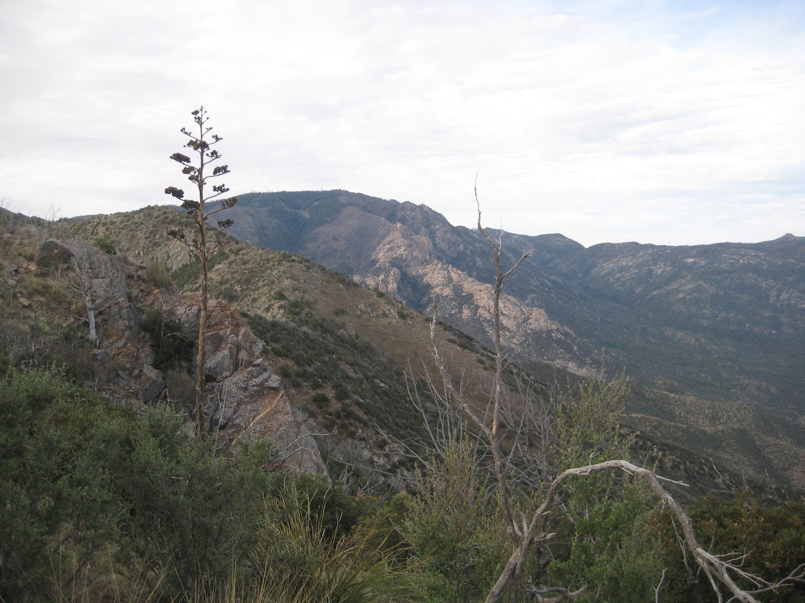
| Mica Mountain - Once on Top |

We both got water and then set up camp just off the trail at the tank where there was a nice flat cement slab. We were getting dinner when some mountain bikers came down the trail and stopped where we were. One had to repair his bike and another talked to us. He and Adam had a mutual friend and before he left asked us if we needed anything. We jokingly mentioned a cold beer would be great. The next thing we knew, he pulled out a 16 oz. stout from his pack; awesome! We talked for a while, shared some pictures, and then fell asleep. Happily, my eyes felt better as the day passed by.
April 2, 2015
Start: West Spring Tank, Passage 10, mile 10.8 (N 32° 19.763 W 110° 40.474).End: Hutch’s Pool, Passage 11, mile 7 (N 32° 22.436 W 110° 47.509).
Miles: ~11.9.
Last night I slept as well as one can for sleeping on concrete with a one inch pad. I don’t remember when I got up, probably a bit after six. I was cooking breakfast when Adam looked at his watch and had that oh no, I’m late look on his face. It was quarter of seven and I’m guessing he wanted to be on the trail at 6:30. Anyway, I took a picture of him, we said good bye, and he was off.
 |
| Krudmeister |
It was close to an hour later when I was finally packed up and ready to go, but first I went and found geocache, West Spring. It was back a bit and up a hill and it was dark last night when we arrived. It was almost eight by the time I really was on the trail. Close to forty minutes later I dropped my pack to find geocache, Bellota View on the Horizon. That was after a pretty good climb so I was ready for a break. The views were nice but I don’t know if Bellota Ranch was visible or not. Shortly after that I crested the hill and stopped for a few minutes to enjoy the view of Molina Basin. I continued a short distance down the other side, then stopped for another geocache, Grandma needs a rest #8- Arizona Trail. Not ten minutes later, there was another geocache, Arizona Trail Challenge. This was one I really wanted to find since to log it one has to find a certain number of caches along the Arizona Trail. Not very many, but still, the theme sucked me in. Just down the hill from there I turned off the trail and wandered up a creek bed to find geocache, The Creek at Molino Basin. The batteries in my GPSr died just when I found it. I changed them out then found one more geocache, RAVEN'S GRASSY, before crossing the Catalina Highway over to the Molina Basin campground.

 |
| Molino Basin |
I got a little confused figuring out where to go to get through the campground, but I finally found the trail. Not far after passing the campground I found another geocache, Family Hike, and then five minutes later I came to a creek with one small tree for shade, so I decided it was time for a break. I took my boots and socks off. I also took my shirt and hat off and rinsed them out in the creek. I filtered some water, ate, and read. I had a really relaxing hour break.
It was about eleven when I got back on the trail. The day had warmed up and the trail climbed for the next mile and a half. Finally the trail crested a saddle and dropped down to the end of the passage at Gordon Hirabayashi trailhead and campground. There was a nice shady spot at the trailhead and I was hungry, so I decided to have lunch. I took my boots and socks off again and read some more while I ate. Onna and Neon hiked by while I was there too. After my rest, I went into the campground and emptied my garbage and used the facilities before getting back on the trail and starting passage 11, Santa Catalina Mountains, at one.
Not long after starting the passage, the trail goes through where the Japanese Internment camp was located. There’s not much there but the reminder of one sad affair of our country. I thought of an old girl friend’s parents and grandmother who were interned. I really liked her grandmother, she was one special lady. Past the camp, Onna and Neon were resting and I talked to them for a minute before continuing. I found out that Bad Animal and The Michigan Wolverine decided to go into Tucson for the night and rest and resupply. I continued on for a few more minutes and found geocache, Sycamore Spider. Onna and Neon walked by while I was doing that and a few minutes later I caught up to them and we climbed up to Shreve Saddle where I dropped my pack to climb up the hill and find geocache, Shreve me this.. Shreve me that. There was a couple hundred foot climb getting to it but there was great views from the cache site.
 |
| Japanese Internment Camp |
 |
| View From Cache Above Shreeve Saddle |
It was almost two by the time I was back on the trail and entered the Pusch Ridge Wilderness. The trail was fun from there. It was downhill and wound around and was fun hiking. The only part I didn’t like was seeing a trail switch backing up the other side of the canyon. It turns out I shouldn’t have worried as that trail isn’t part of the Arizona Trail. The trail crosses Bear Canyon, then levels out and goes in and out of shady trees for the next mile where I found Neon and Onna resting at a creek. I stopped and joined them. The left shortly after I arrived, Neon pointing to a nice pool, so I dunked myself in it. It felt good to submerge myself in the cool water.

I didn’t take too long of a break and was back on the trail about twenty past three. From there the trail drops into the East Fork of Sabino Canyon. Around four, I dropped my pack to find another geocache, O_dog #1. It’s an older cache, hidden late December of 2001. I had to drop down from the trail and cross the creek to reach the cache. At quarter past four, I was back on the trail. Maybe half a mile later, the trail follows Sabino Creek. Somewhere in there I met up with Onna and Neon again and we hiked along. We passed a large rock with metates ground in it and then stopped for a few minutes where the trail crossed the creek. They stopped to get water and I decided to continue farther to get water then we’d camp together for the evening.

 |
| Neon |
 |
| Metates |
I didn’t realize it, but I ended up taking the trail to Hutch’s Pool and started to get water. I thought Onna and Neon would come by but they stayed on the trail. It was so nice where I was, I decided to make camp. I felt bad about missing them for camp since we had made plans.
It was really nice where I camped but there was some bugs out so I decided to set up the tent. After dinner I read some more before turning out the lights for the night. I didn’t even make it twelve miles today but I did find ten caches and took lots of breaks. At any rate, I was happy with the day and was camping in a great spot. It was nice to fall asleep to the gurgling creek.
 |
| Hutch's Pool |
 |
| Camp |
April 3, 2015
Start: Hutch’s Pool, Passage 11, mile 7 (N 32° 22.436 W 110° 47.509).End: Passage 12, mile 12.7 (N 32° 30.000 W 110° 44.888).
Miles: ~17.4.
I slept pretty good last night and was up and on the trail by quarter past seven. My best start so far this trip. The day started with a short climb up and into to the west fork of Sabino Canyon. I really enjoyed the morning and at quarter of nine reached the Cathedral Rock trail junction. It was a lovely spot, all shaded with oaks so I stopped for a break. From there the trail crossed the creek and ascended up to Romero Pass. The climb wasn’t steep; the grade suited me and I was enjoying climb and the views it afforded me. I passed another hiker going the other way but we just said hello in passing.

 |
| Cathedral Rock Trail Junction |

When I reached Romero Pass, the end of the passage, there was an older man there with a younger boy and girl. They were planning on hiking into Sabino Canyon and taking the tram out. I changed the batteries in my GPSr and was offered a sandwich by the boy. I had enough food and was planning on a cookie in Summerhaven so I said thanks, but no.
I soon started passage 12, Oracle Ridge. So far I had been enjoying the day’s walk but the trail leaving Romero Pass was very steep and gained about 1400’ in a mile and a half. It took me an hour to make the climb and when I reached the top, I was very tired and ready for a break. I found a shady spot, took my boots and socks off and mixed up some Gatorade. While resting, a group of day hikers climbed up on the rock in front of me and checked out the view. When I arrived, I’d been too tired to bother, but they all ran right up. I mustered up the energy and followed them up and looked out; the views were spectacular, well worth the effort. I asked them if they’d seen any water on the trail, as I was getting low. They hadn’t but they didn’t come the way I was going either. I went back to my resting spot and they soon left as did I. It was getting cold sitting in the shade.


I soon entered the Wilderness of Rocks. The trail dropped a few hundred feet at first, then undulated along and wound in and out of the rocks. I think any other time I really would have enjoyed the walking but I was feeling really tired. I was still feeling the effects of the mornings climb. After about an hour of slogging along I stopped at a nice crossing of Lemon Creek. I spent about an hour there resting, eating, and getting water.
 |
| Wilderness of Rocks |
I felt better after the break but I was still tired. It didn’t help that the trail climbed 800’ in the next mile and a half either but once I crossed Marshall Saddle I was happy to have downhill all the way to the Marshall Gulch trailhead.
 |
| Marshall Saddle Area |
Just past the saddle, I met a couple hiking the other way. It turns out they were section hiking the Arizona Trail too, and were on their last section. They seemed pretty stoked to be near done, I know I would be.
I felt much better hiking the mile to the Marshall Gulch trailhead. It’s amazing what a decent stretch of downhill will do. Once at the trailhead, the energy carried me up the road into Summerhaven.
I’d been hearing about these huge cookies at the Cookie Cabin, plus there was a sign for pizza outside so I turned off the road. As I was about to head up the stairs to the restaurant, Onna and Neon called me. They were on the patio eating pizza and cookies and ice cream. I pulled up a chair and joined them. We talked for a few minutes, then I went inside and ordered a cookie and a brat. The brat was calling me harder than pizza. The brat was incredible. I should have ordered two and skipped the cookie. The cookie was huge. I was able to eat about a third of it before I got completely sick of it. It would be good to share with four people. I didn’t even take the leftovers with me. I probably should have but at the time, more cookie was the last thing in the world I wanted.
 |
| Summerhaven Cookie Cabin |
It was almost five when I finally left the Cookie Cabin. Onna and Neon left a few minutes earlier and I went and filled up with water. It sure is nice not to have to filter. As I was leaving Summerhaven, I stopped and found geocache, Generally Stored, then continued along the Catalina Highway to the Oracle Ridge trail and single track.

It was about ten past six when I caught back up with Neon and Onna and not long after that we reached Dan Saddle. I dropped my pack because I wanted to find geocache, Dan Saddle. I was thinking we might camp there so I headed towards the cache, realized I didn’t have a pen so I went back to my pack, then headed towards the cache again. Realized we weren’t going to camp there so I went back and got my pack, then headed towards the cache. What a back and forth mess. Anyway, I found the cache and took off after Onna and Neon.


 |
| Onna and Neon |
We hiked for another forty-five minutes or so. It was getting dark out and difficult to see so we finally got our lights out. We were on a ridge and it was difficult finding a place to camp. There was a spot big enough for one so I took it. Onna and Neon found a place maybe a hundred yards farther.
It was a great night out so I decided to cowboy camp. There was a slight slope so I put my pack at my feet to keep me from sliding down. I had my dinner and checked out how far I had left. Close to eighteen miles. I was glad we didn’t camp at Dan Saddle, then it would have been a long day. I turned my phone on and had service so I checked things out for a few minutes before calling it a night.
 |
| Sunset |
I had a full moon the last night. I didn’t know it, but there would also be a total lunar eclipse. Sometime early in the morning, I woke up and the moon was a dark orange and was in partial eclipse. I watched it for a few minutes before falling back to sleep.
April 4, 2015
Start: Passage 12, mile 12.7 (N 32° 30.000 W 110° 44.888).End: Tiger Mine TH.
Miles: ~17.7.
 |
| Lunar Eclipse |
I woke up before six while the moon was still in partial eclipse. I watched it for a while then got up and watched the sunrise. After that I got breakfast, instant oatmeal. I sometimes have trouble eating oatmeal and this morning was particularly bad. I was gagging on most every bite and ended up throwing a bunch out. I just couldn’t get myself to eat any more.
 |
| Sunrise |
It seems that I should be able to break camp more quickly after cowboy camping but it was twenty-five of eight by the time I was walking down the trail. The trail descends a road down Oracle Ridge, steeply at times, along the west side of Rice Peak. There was great views to the north and west. After close to an hour, I stopped to find geocache, Arizona Trail - Beat Feet.
 |
| View with Biosphere 2 |
I continued descending the ridge over an hour longer before I stopped for an hour’s break at quarter of ten shortly after passing some cute round tin trail signs. The trail was along a slope and I had great views to the north as I rested. While there, two men thru-hiking the trail passed me. We exchanged a few words as they passed but they didn’t stop. After they were gone, I wondered if they were the two Warrior Hikers hiking the Arizona Trail. I hoped I’d see them later and find out.


After my break, I had about four miles to the American Flag trailhead. I’d already dropped about 1800’ from where I camped and had about 1000’ more to there. As I descended the trail turned from Junipers to Palo Verdes and Mesquite. It really was a pretty walk, especially as I neared American Flag. Not long before I reached the trailhead, I found geocache, AMERICAN FLAG. It was a quick find and a few minutes later I reached the end of passage 12 at the trailhead. The two men that passed me on the trail were there along with a reporter. It turns out they were the Warrior Hikers. I sat down and chatted with them for a while. They were waiting for the VFW Commandant from nearby San Manual to come and get them.
 |
| American Flag Trailhead |
 |
| Warrior Hikers |
It was almost one-thirty when I started passage 13, Oracle. I tried calling Barbara while at the trailhead but wasn’t able to connect, so I sent her a text letting her know I expected to be done at five. I didn’t know if she got the text so at two, I sent another signal on my SPOT as a backup plan we had made. I figured she would get at least one of those.
The trail was mostly level with good tread so it was easy walking. I made good time but the day was wearing and I wanted to make sure I was done by five. At three, I came to the Kannally Wash windmill. It was warm and I was feeling tired and was over halfway done with the passage so it seemed like a good place for one last rest. There were two day hikers there. We talked for a couple minutes, then I went and sat down in the shade of a tree and took my boots and socks off and had a snack and some drink.
I kept the break short and was back on the trail before three-thirty. That gave me a good hour and a half to finish the passage. The trail climbed out of Kannally Wash then went up and down some for the next two miles where it crossed under highway 77 where I found geocache, Arizona. I noticed a couple friends of mine that geocache had signed the log earlier today. It would have been fun to have seen them at the cache.
From there, the trail follows Tiger Mine Road for almost two miles to the trailhead. I was wondering if Barbara might pass me as I neared the end but she didn’t. That was good because she’s doing me a favor helping me. I don’t mind waiting for her, but I don’t want her to have to wait for me.
My feet were getting a little sore as I finished up but not too bad. I developed some minor blisters today but that was okay as this hike was essentially over. I timed my finish perfectly as I reached the Tiger Mine trailhead just before five.
 |
| Nearing the End |
 |
| Finished at the Tiger Mine Trailhead |
I was able to contact Barbara and she was still a ways out as she had missed a turn. I pulled out my sleeping pad and took my boots off and relaxed as I waited for her to arrive. It felt really good to be done and to have filled a gap in my progress along the trail.
It was great seeing Barbara when she arrived. I threw my gear in the truck, washed off some, and changed into clean clothes. We drove into Oracle for dinner at an Italian restaurant. When we went in, Neon and Onna were there. We sat with them for dinner. I was really happy that Barbara was able to meet them. After dinner, we said good bye. Everybody went outside, but I went to the bathroom before going to the truck. I thought I should have offered Onna and Neon a ride back to their room, but when I got in the truck, they were already in the back. We dropped them off at their room, said good bye, and headed home.
No comments:
Post a Comment